You are here: Home > Network List > IU - Global Seismograph Network (GSN - IRIS/USGS) Stations List
> Station CTAO Charters Towers, Australia > Earthquake Result Viewer
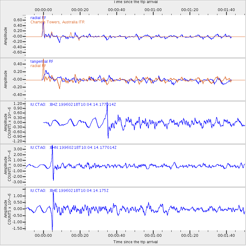
CTAO Charters Towers, Australia - Earthquake Result Viewer
*The percent match for this event was below the threshold and hence no stack was calculated.
| Earthquake location: |
Mindoro, Philippines |
| Earthquake latitude/longitude: |
13.9/120.8 |
| Earthquake time(UTC): |
1996/02/18 (049) 09:57:16 GMT |
| Earthquake Depth: |
242 km |
| Earthquake Magnitude: |
5.6 UNKNOWN, 5.4 MB |
| Earthquake Catalog/Contributor: |
WHDF/NEIC |
|
| Network: |
IU Global Seismograph Network (GSN - IRIS/USGS) |
| Station: |
CTAO Charters Towers, Australia |
| Lat/Lon: |
20.09 S/146.25 E |
| Elevation: |
357 m |
|
| Distance: |
42.0 deg |
| Az: |
142.858 deg |
| Baz: |
321.4 deg |
| Ray Param: |
$rayparam |
*The percent match for this event was below the threshold and hence was not used in the summary stack. |
|
| Radial Match: |
68.88703 % |
| Radial Bump: |
400 |
| Transverse Match: |
48.96117 % |
| Transverse Bump: |
400 |
| SOD ConfigId: |
4480 |
| Insert Time: |
2010-03-03 14:34:11.850 +0000 |
| GWidth: |
2.5 |
| Max Bumps: |
400 |
| Tol: |
0.001 |
|
Signal To Noise
| Channel | StoN | STA | LTA |
| IU:CTAO: :BHN:19960218T10:04:14.177014Z | 3.4921036 | 7.668321E-7 | 2.1959032E-7 |
| IU:CTAO: :BHE:19960218T10:04:14.175Z | 3.2007651 | 3.1649088E-7 | 9.887976E-8 |
| IU:CTAO: :BHZ:19960218T10:04:14.177014Z | 2.8594618 | 3.6171554E-7 | 1.2649777E-7 |
| Arrivals |
| Ps | |
| PpPs | |
| PsPs/PpSs | |


