You are here: Home > Network List > US - United States National Seismic Network Stations List
> Station HAWA Hanford, Washington, USA > Earthquake Result Viewer
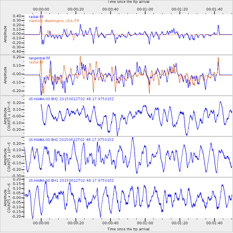
HAWA Hanford, Washington, USA - Earthquake Result Viewer
*The percent match for this event was below the threshold and hence no stack was calculated.
| Earthquake location: |
Tonga Islands |
| Earthquake latitude/longitude: |
-21.0/-173.9 |
| Earthquake time(UTC): |
2015/06/12 (163) 02:36:24 GMT |
| Earthquake Depth: |
16 km |
| Earthquake Magnitude: |
5.1 MW |
| Earthquake Catalog/Contributor: |
ISC/ISC |
|
| Network: |
US United States National Seismic Network |
| Station: |
HAWA Hanford, Washington, USA |
| Lat/Lon: |
46.39 N/119.53 W |
| Elevation: |
364 m |
|
| Distance: |
83.1 deg |
| Az: |
34.535 deg |
| Baz: |
229.95 deg |
| Ray Param: |
$rayparam |
*The percent match for this event was below the threshold and hence was not used in the summary stack. |
|
| Radial Match: |
47.19171 % |
| Radial Bump: |
400 |
| Transverse Match: |
43.332077 % |
| Transverse Bump: |
400 |
| SOD ConfigId: |
7422571 |
| Insert Time: |
2019-04-19 07:49:01.343 +0000 |
| GWidth: |
2.5 |
| Max Bumps: |
400 |
| Tol: |
0.001 |
|
Signal To Noise
| Channel | StoN | STA | LTA |
| US:HAWA:00:BHZ:20150612T02:48:17.975015Z | 1.0468442 | 1.2292912E-7 | 1.1742828E-7 |
| US:HAWA:00:BH1:20150612T02:48:17.975015Z | 1.3722004 | 1.1356701E-7 | 8.27627E-8 |
| US:HAWA:00:BH2:20150612T02:48:17.975015Z | 1.7730969 | 1.2288609E-7 | 6.930591E-8 |
| Arrivals |
| Ps | |
| PpPs | |
| PsPs/PpSs | |


