You are here: Home > Network List > US - United States National Seismic Network Stations List
> Station ELK Elko, Nevada, USA > Earthquake Result Viewer
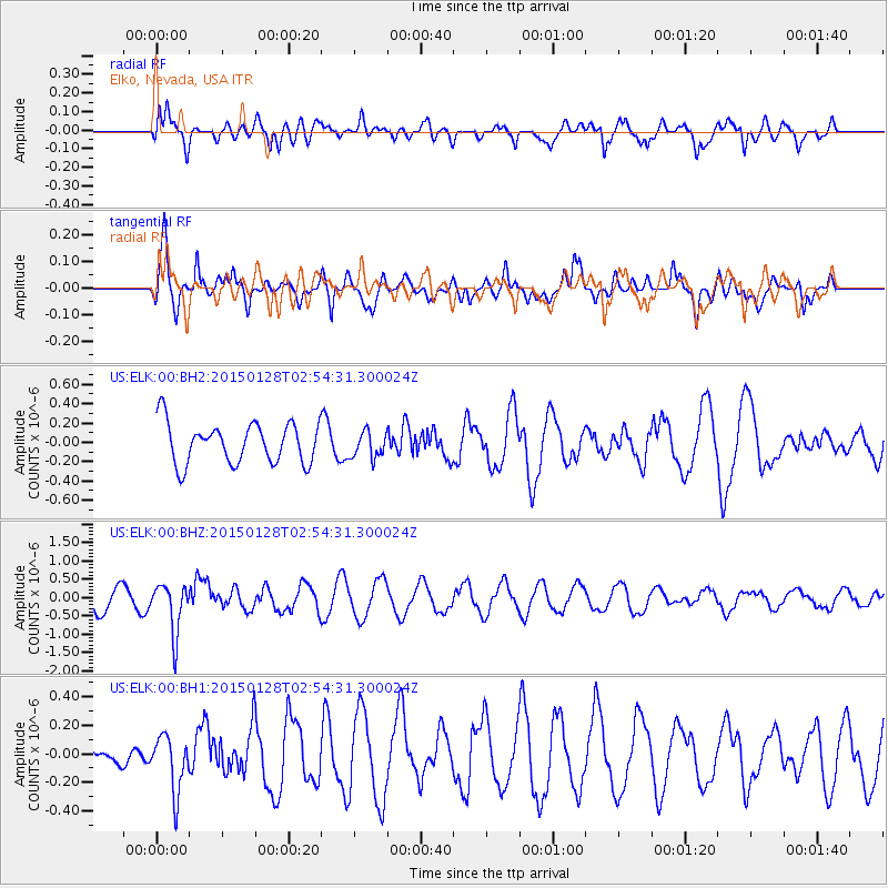
ELK Elko, Nevada, USA - Earthquake Result Viewer
*The percent match for this event was below the threshold and hence no stack was calculated.
| Earthquake location: |
Fiji Islands Region |
| Earthquake latitude/longitude: |
-20.9/-178.4 |
| Earthquake time(UTC): |
2015/01/28 (028) 02:43:19 GMT |
| Earthquake Depth: |
484 km |
| Earthquake Magnitude: |
6.1 MWP |
| Earthquake Catalog/Contributor: |
NEIC PDE/NEIC COMCAT |
|
| Network: |
US United States National Seismic Network |
| Station: |
ELK Elko, Nevada, USA |
| Lat/Lon: |
40.74 N/115.24 W |
| Elevation: |
2210 m |
|
| Distance: |
84.8 deg |
| Az: |
42.879 deg |
| Baz: |
236.859 deg |
| Ray Param: |
$rayparam |
*The percent match for this event was below the threshold and hence was not used in the summary stack. |
|
| Radial Match: |
62.690525 % |
| Radial Bump: |
400 |
| Transverse Match: |
67.15995 % |
| Transverse Bump: |
374 |
| SOD ConfigId: |
837871 |
| Insert Time: |
2015-02-11 05:29:49.299 +0000 |
| GWidth: |
2.5 |
| Max Bumps: |
400 |
| Tol: |
0.001 |
|
Signal To Noise
| Channel | StoN | STA | LTA |
| US:ELK:00:BHZ:20150128T02:54:31.300024Z | 1.9113001 | 6.6945637E-7 | 3.502623E-7 |
| US:ELK:00:BH1:20150128T02:54:31.300024Z | 2.962925 | 1.9446246E-7 | 6.563192E-8 |
| US:ELK:00:BH2:20150128T02:54:31.300024Z | 0.64563125 | 1.3609423E-7 | 2.1079252E-7 |
| Arrivals |
| Ps | |
| PpPs | |
| PsPs/PpSs | |


