You are here: Home > Network List > US - United States National Seismic Network Stations List
> Station HAWA Hanford, Washington, USA > Earthquake Result Viewer
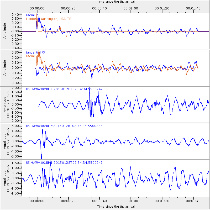
HAWA Hanford, Washington, USA - Earthquake Result Viewer
*The percent match for this event was below the threshold and hence no stack was calculated.
| Earthquake location: |
Fiji Islands Region |
| Earthquake latitude/longitude: |
-20.9/-178.4 |
| Earthquake time(UTC): |
2015/01/28 (028) 02:43:19 GMT |
| Earthquake Depth: |
484 km |
| Earthquake Magnitude: |
6.1 MWP |
| Earthquake Catalog/Contributor: |
NEIC PDE/NEIC COMCAT |
|
| Network: |
US United States National Seismic Network |
| Station: |
HAWA Hanford, Washington, USA |
| Lat/Lon: |
46.39 N/119.53 W |
| Elevation: |
364 m |
|
| Distance: |
85.5 deg |
| Az: |
36.442 deg |
| Baz: |
233.359 deg |
| Ray Param: |
$rayparam |
*The percent match for this event was below the threshold and hence was not used in the summary stack. |
|
| Radial Match: |
73.37019 % |
| Radial Bump: |
400 |
| Transverse Match: |
47.22036 % |
| Transverse Bump: |
400 |
| SOD ConfigId: |
837871 |
| Insert Time: |
2015-02-11 05:29:50.903 +0000 |
| GWidth: |
2.5 |
| Max Bumps: |
400 |
| Tol: |
0.001 |
|
Signal To Noise
| Channel | StoN | STA | LTA |
| US:HAWA:00:BHZ:20150128T02:54:34.550024Z | 4.9360924 | 2.2681359E-6 | 4.5950028E-7 |
| US:HAWA:00:BH1:20150128T02:54:34.550024Z | 1.1651093 | 4.7494598E-7 | 4.076407E-7 |
| US:HAWA:00:BH2:20150128T02:54:34.550024Z | 2.6525621 | 7.3464446E-7 | 2.7695654E-7 |
| Arrivals |
| Ps | |
| PpPs | |
| PsPs/PpSs | |


