You are here: Home > Network List > IU - Global Seismograph Network (GSN - IRIS/USGS) Stations List
> Station CTAO Charters Towers, Australia > Earthquake Result Viewer
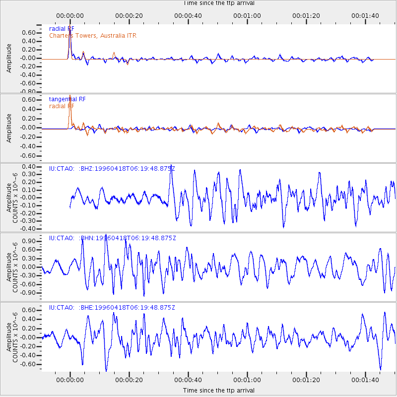
CTAO Charters Towers, Australia - Earthquake Result Viewer
*The percent match for this event was below the threshold and hence no stack was calculated.
| Earthquake location: |
Samar, Philippines |
| Earthquake latitude/longitude: |
12.8/125.0 |
| Earthquake time(UTC): |
1996/04/18 (109) 06:12:57 GMT |
| Earthquake Depth: |
33 km |
| Earthquake Magnitude: |
5.5 MB, 5.7 MS, 6.0 UNKNOWN, 5.8 MW |
| Earthquake Catalog/Contributor: |
WHDF/NEIC |
|
| Network: |
IU Global Seismograph Network (GSN - IRIS/USGS) |
| Station: |
CTAO Charters Towers, Australia |
| Lat/Lon: |
20.09 S/146.25 E |
| Elevation: |
357 m |
|
| Distance: |
38.8 deg |
| Az: |
147.049 deg |
| Baz: |
325.635 deg |
| Ray Param: |
$rayparam |
*The percent match for this event was below the threshold and hence was not used in the summary stack. |
|
| Radial Match: |
78.765144 % |
| Radial Bump: |
302 |
| Transverse Match: |
59.518585 % |
| Transverse Bump: |
400 |
| SOD ConfigId: |
4480 |
| Insert Time: |
2010-03-03 14:34:55.189 +0000 |
| GWidth: |
2.5 |
| Max Bumps: |
400 |
| Tol: |
0.001 |
|
Signal To Noise
| Channel | StoN | STA | LTA |
| IU:CTAO: :BHN:19960418T06:19:48.875Z | 2.5546515 | 3.4921155E-7 | 1.3669636E-7 |
| IU:CTAO: :BHE:19960418T06:19:48.875Z | 2.8501372 | 2.046635E-7 | 7.1808294E-8 |
| IU:CTAO: :BHZ:19960418T06:19:48.875Z | 2.5807157 | 1.5201478E-7 | 5.890412E-8 |
| Arrivals |
| Ps | |
| PpPs | |
| PsPs/PpSs | |


