You are here: Home > Network List > UU - University of Utah Regional Network Stations List
> Station CCUT Cedar City, UT, USA > Earthquake Result Viewer
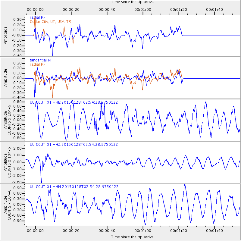
CCUT Cedar City, UT, USA - Earthquake Result Viewer
*The percent match for this event was below the threshold and hence no stack was calculated.
| Earthquake location: |
Fiji Islands Region |
| Earthquake latitude/longitude: |
-20.9/-178.4 |
| Earthquake time(UTC): |
2015/01/28 (028) 02:43:19 GMT |
| Earthquake Depth: |
484 km |
| Earthquake Magnitude: |
6.1 MWP |
| Earthquake Catalog/Contributor: |
NEIC PDE/NEIC COMCAT |
|
| Network: |
UU University of Utah Regional Network |
| Station: |
CCUT Cedar City, UT, USA |
| Lat/Lon: |
37.55 N/113.36 W |
| Elevation: |
2127 m |
|
| Distance: |
84.3 deg |
| Az: |
46.369 deg |
| Baz: |
238.37 deg |
| Ray Param: |
$rayparam |
*The percent match for this event was below the threshold and hence was not used in the summary stack. |
|
| Radial Match: |
78.40483 % |
| Radial Bump: |
400 |
| Transverse Match: |
66.94682 % |
| Transverse Bump: |
342 |
| SOD ConfigId: |
837871 |
| Insert Time: |
2015-02-11 05:30:35.353 +0000 |
| GWidth: |
2.5 |
| Max Bumps: |
400 |
| Tol: |
0.001 |
|
Signal To Noise
| Channel | StoN | STA | LTA |
| UU:CCUT:01:HHZ:20150128T02:54:28.975012Z | 3.2562468 | 1.0466395E-6 | 3.214251E-7 |
| UU:CCUT:01:HHN:20150128T02:54:28.975012Z | 0.61938864 | 3.5265214E-7 | 5.693552E-7 |
| UU:CCUT:01:HHE:20150128T02:54:28.975012Z | 0.58922446 | 2.9151957E-7 | 4.9475125E-7 |
| Arrivals |
| Ps | |
| PpPs | |
| PsPs/PpSs | |


