You are here: Home > Network List > IU - Global Seismograph Network (GSN - IRIS/USGS) Stations List
> Station CTAO Charters Towers, Australia > Earthquake Result Viewer
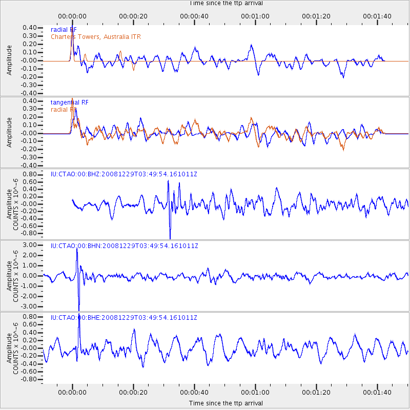
CTAO Charters Towers, Australia - Earthquake Result Viewer
*The percent match for this event was below the threshold and hence no stack was calculated.
| Earthquake location: |
Afghanistan-Tajikistan Bord Reg. |
| Earthquake latitude/longitude: |
36.4/71.1 |
| Earthquake time(UTC): |
2008/12/29 (364) 03:37:41 GMT |
| Earthquake Depth: |
158 km |
| Earthquake Magnitude: |
5.9 MB, 5.8 MW, 5.8 MW |
| Earthquake Catalog/Contributor: |
WHDF/NEIC |
|
| Network: |
IU Global Seismograph Network (GSN - IRIS/USGS) |
| Station: |
CTAO Charters Towers, Australia |
| Lat/Lon: |
20.09 S/146.25 E |
| Elevation: |
357 m |
|
| Distance: |
90.4 deg |
| Az: |
114.679 deg |
| Baz: |
308.743 deg |
| Ray Param: |
$rayparam |
*The percent match for this event was below the threshold and hence was not used in the summary stack. |
|
| Radial Match: |
68.42102 % |
| Radial Bump: |
400 |
| Transverse Match: |
77.021416 % |
| Transverse Bump: |
400 |
| SOD ConfigId: |
2658 |
| Insert Time: |
2010-03-03 14:35:11.902 +0000 |
| GWidth: |
2.5 |
| Max Bumps: |
400 |
| Tol: |
0.001 |
|
Signal To Noise
| Channel | StoN | STA | LTA |
| IU:CTAO:00:BHN:20081229T03:49:54.161011Z | 5.988334 | 1.132587E-6 | 1.8913225E-7 |
| IU:CTAO:00:BHE:20081229T03:49:54.161011Z | 1.2029526 | 2.5154387E-7 | 2.0910538E-7 |
| IU:CTAO:00:BHZ:20081229T03:49:54.161011Z | 2.4514573 | 3.0043827E-7 | 1.2255498E-7 |
| Arrivals |
| Ps | |
| PpPs | |
| PsPs/PpSs | |


