You are here: Home > Network List > IU - Global Seismograph Network (GSN - IRIS/USGS) Stations List
> Station CTAO Charters Towers, Australia > Earthquake Result Viewer
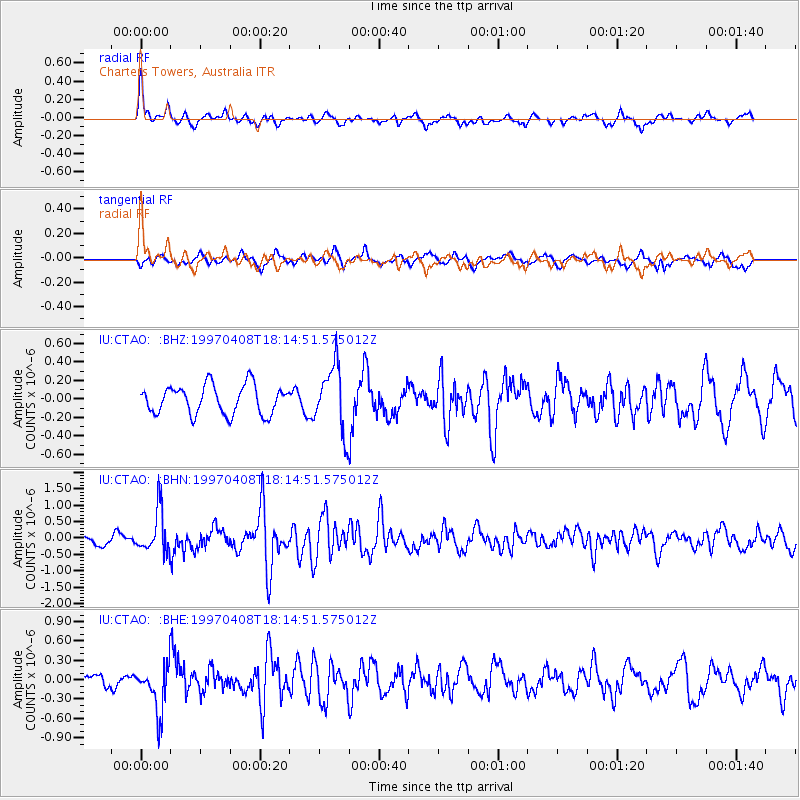
CTAO Charters Towers, Australia - Earthquake Result Viewer
*The percent match for this event was below the threshold and hence no stack was calculated.
| Earthquake location: |
Luzon, Philippines |
| Earthquake latitude/longitude: |
18.3/121.0 |
| Earthquake time(UTC): |
1997/04/08 (098) 18:07:09 GMT |
| Earthquake Depth: |
71 km |
| Earthquake Magnitude: |
6.0 MB, 5.9 UNKNOWN, 5.9 MW |
| Earthquake Catalog/Contributor: |
WHDF/NEIC |
|
| Network: |
IU Global Seismograph Network (GSN - IRIS/USGS) |
| Station: |
CTAO Charters Towers, Australia |
| Lat/Lon: |
20.09 S/146.25 E |
| Elevation: |
357 m |
|
| Distance: |
45.5 deg |
| Az: |
145.741 deg |
| Baz: |
325.322 deg |
| Ray Param: |
$rayparam |
*The percent match for this event was below the threshold and hence was not used in the summary stack. |
|
| Radial Match: |
64.80162 % |
| Radial Bump: |
332 |
| Transverse Match: |
48.40272 % |
| Transverse Bump: |
370 |
| SOD ConfigId: |
4480 |
| Insert Time: |
2010-03-03 14:35:15.782 +0000 |
| GWidth: |
2.5 |
| Max Bumps: |
400 |
| Tol: |
0.001 |
|
Signal To Noise
| Channel | StoN | STA | LTA |
| IU:CTAO: :BHN:19970408T18:14:51.575012Z | 5.0449452 | 6.619391E-7 | 1.3120838E-7 |
| IU:CTAO: :BHE:19970408T18:14:51.575012Z | 2.5128229 | 3.7469243E-7 | 1.4911215E-7 |
| IU:CTAO: :BHZ:19970408T18:14:51.575012Z | 2.2992175 | 3.5697437E-7 | 1.5525906E-7 |
| Arrivals |
| Ps | |
| PpPs | |
| PsPs/PpSs | |


