You are here: Home > Network List > CI - Caltech Regional Seismic Network Stations List
> Station SMM Simmler, CA, USA > Earthquake Result Viewer
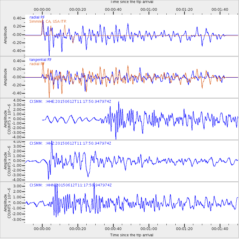
SMM Simmler, CA, USA - Earthquake Result Viewer
*The percent match for this event was below the threshold and hence no stack was calculated.
| Earthquake location: |
Samoa Islands Region |
| Earthquake latitude/longitude: |
-15.6/-173.0 |
| Earthquake time(UTC): |
2015/06/12 (163) 11:07:04 GMT |
| Earthquake Depth: |
29 km |
| Earthquake Magnitude: |
6.3 MO |
| Earthquake Catalog/Contributor: |
NEIC PDE/NEIC ALERT |
|
| Network: |
CI Caltech Regional Seismic Network |
| Station: |
SMM Simmler, CA, USA |
| Lat/Lon: |
35.31 N/120.00 W |
| Elevation: |
599 m |
|
| Distance: |
71.3 deg |
| Az: |
43.593 deg |
| Baz: |
234.339 deg |
| Ray Param: |
$rayparam |
*The percent match for this event was below the threshold and hence was not used in the summary stack. |
|
| Radial Match: |
65.24495 % |
| Radial Bump: |
400 |
| Transverse Match: |
73.769226 % |
| Transverse Bump: |
400 |
| SOD ConfigId: |
7422571 |
| Insert Time: |
2019-04-19 07:53:52.348 +0000 |
| GWidth: |
2.5 |
| Max Bumps: |
400 |
| Tol: |
0.001 |
|
Signal To Noise
| Channel | StoN | STA | LTA |
| CI:SMM: :HHZ:20150612T11:17:50.947974Z | 11.50747 | 1.221536E-6 | 1.0615157E-7 |
| CI:SMM: :HHN:20150612T11:17:50.947974Z | 0.78600615 | 3.1503026E-7 | 4.0079874E-7 |
| CI:SMM: :HHE:20150612T11:17:50.947974Z | 0.73778033 | 3.2092026E-7 | 4.349808E-7 |
| Arrivals |
| Ps | |
| PpPs | |
| PsPs/PpSs | |


