You are here: Home > Network List > IU - Global Seismograph Network (GSN - IRIS/USGS) Stations List
> Station CTAO Charters Towers, Australia > Earthquake Result Viewer
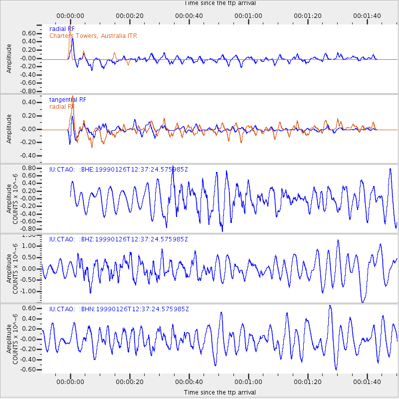
CTAO Charters Towers, Australia - Earthquake Result Viewer
*The percent match for this event was below the threshold and hence no stack was calculated.
| Earthquake location: |
Tonga Islands |
| Earthquake latitude/longitude: |
-20.5/-174.2 |
| Earthquake time(UTC): |
1999/01/26 (026) 12:30:49 GMT |
| Earthquake Depth: |
41 km |
| Earthquake Magnitude: |
5.5 MB, 5.5 MS, 5.9 MW, 5.8 MW |
| Earthquake Catalog/Contributor: |
WHDF/NEIC |
|
| Network: |
IU Global Seismograph Network (GSN - IRIS/USGS) |
| Station: |
CTAO Charters Towers, Australia |
| Lat/Lon: |
20.09 S/146.25 E |
| Elevation: |
357 m |
|
| Distance: |
37.0 deg |
| Az: |
263.562 deg |
| Baz: |
97.696 deg |
| Ray Param: |
$rayparam |
*The percent match for this event was below the threshold and hence was not used in the summary stack. |
|
| Radial Match: |
61.754368 % |
| Radial Bump: |
400 |
| Transverse Match: |
61.180767 % |
| Transverse Bump: |
400 |
| SOD ConfigId: |
4480 |
| Insert Time: |
2010-03-03 14:35:34.347 +0000 |
| GWidth: |
2.5 |
| Max Bumps: |
400 |
| Tol: |
0.001 |
|
Signal To Noise
| Channel | StoN | STA | LTA |
| IU:CTAO: :BHZ:19990126T12:37:24.575985Z | 1.3917278 | 3.2065847E-7 | 2.3040316E-7 |
| IU:CTAO: :BHN:19990126T12:37:24.575985Z | 1.0062994 | 1.6808028E-7 | 1.670281E-7 |
| IU:CTAO: :BHE:19990126T12:37:24.575985Z | 1.9847958 | 4.5561146E-7 | 2.295508E-7 |
| Arrivals |
| Ps | |
| PpPs | |
| PsPs/PpSs | |


