You are here: Home > Network List > IU - Global Seismograph Network (GSN - IRIS/USGS) Stations List
> Station CTAO Charters Towers, Australia > Earthquake Result Viewer
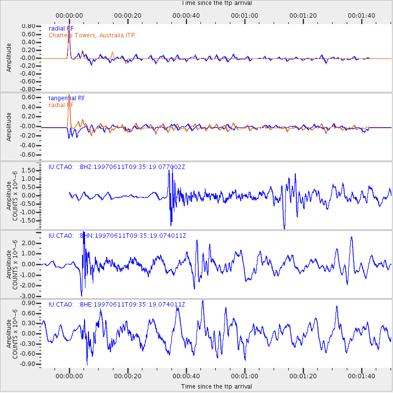
CTAO Charters Towers, Australia - Earthquake Result Viewer
*The percent match for this event was below the threshold and hence no stack was calculated.
| Earthquake location: |
South Of Fiji Islands |
| Earthquake latitude/longitude: |
-24.0/-177.5 |
| Earthquake time(UTC): |
1997/06/11 (162) 09:29:23 GMT |
| Earthquake Depth: |
164 km |
| Earthquake Magnitude: |
5.9 UNKNOWN, 5.4 MB, 5.5 MB |
| Earthquake Catalog/Contributor: |
WHDF/NEIC |
|
| Network: |
IU Global Seismograph Network (GSN - IRIS/USGS) |
| Station: |
CTAO Charters Towers, Australia |
| Lat/Lon: |
20.09 S/146.25 E |
| Elevation: |
357 m |
|
| Distance: |
33.8 deg |
| Az: |
269.374 deg |
| Baz: |
103.296 deg |
| Ray Param: |
$rayparam |
*The percent match for this event was below the threshold and hence was not used in the summary stack. |
|
| Radial Match: |
77.5653 % |
| Radial Bump: |
284 |
| Transverse Match: |
67.62766 % |
| Transverse Bump: |
400 |
| SOD ConfigId: |
4480 |
| Insert Time: |
2010-03-03 14:35:57.728 +0000 |
| GWidth: |
2.5 |
| Max Bumps: |
400 |
| Tol: |
0.001 |
|
Signal To Noise
| Channel | StoN | STA | LTA |
| IU:CTAO: :BHN:19970611T09:35:19.074011Z | 3.3728733 | 9.3931953E-7 | 2.784924E-7 |
| IU:CTAO: :BHE:19970611T09:35:19.074011Z | 0.6321406 | 1.5669072E-7 | 2.4787323E-7 |
| IU:CTAO: :BHZ:19970611T09:35:19.077002Z | 5.0494514 | 5.160847E-7 | 1.02206094E-7 |
| Arrivals |
| Ps | |
| PpPs | |
| PsPs/PpSs | |


