You are here: Home > Network List > IU - Global Seismograph Network (GSN - IRIS/USGS) Stations List
> Station CTAO Charters Towers, Australia > Earthquake Result Viewer
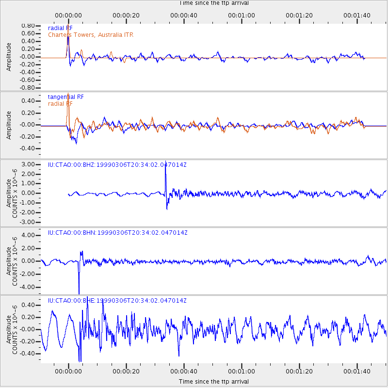
CTAO Charters Towers, Australia - Earthquake Result Viewer
*The percent match for this event was below the threshold and hence no stack was calculated.
| Earthquake location: |
Fiji Islands Region |
| Earthquake latitude/longitude: |
-21.7/-179.5 |
| Earthquake time(UTC): |
1999/03/06 (065) 20:28:53 GMT |
| Earthquake Depth: |
603 km |
| Earthquake Magnitude: |
5.4 MB, 5.8 MW, 5.7 MW |
| Earthquake Catalog/Contributor: |
WHDF/NEIC |
|
| Network: |
IU Global Seismograph Network (GSN - IRIS/USGS) |
| Station: |
CTAO Charters Towers, Australia |
| Lat/Lon: |
20.09 S/146.25 E |
| Elevation: |
357 m |
|
| Distance: |
32.0 deg |
| Az: |
266.591 deg |
| Baz: |
99.083 deg |
| Ray Param: |
$rayparam |
*The percent match for this event was below the threshold and hence was not used in the summary stack. |
|
| Radial Match: |
62.59567 % |
| Radial Bump: |
400 |
| Transverse Match: |
66.466 % |
| Transverse Bump: |
400 |
| SOD ConfigId: |
4480 |
| Insert Time: |
2010-03-03 14:36:18.749 +0000 |
| GWidth: |
2.5 |
| Max Bumps: |
400 |
| Tol: |
0.001 |
|
Signal To Noise
| Channel | StoN | STA | LTA |
| IU:CTAO:00:BHN:19990306T20:34:02.047014Z | 3.7152748 | 1.0259732E-6 | 2.7615002E-7 |
| IU:CTAO:00:BHE:19990306T20:34:02.047014Z | 1.1932634 | 2.0193619E-7 | 1.6923018E-7 |
| IU:CTAO:00:BHZ:19990306T20:34:02.047014Z | 6.7716017 | 7.0695535E-7 | 1.0440002E-7 |
| Arrivals |
| Ps | |
| PpPs | |
| PsPs/PpSs | |


