You are here: Home > Network List > IU - Global Seismograph Network (GSN - IRIS/USGS) Stations List
> Station XMAS Kiritimati Island, Republic of Kiribati > Earthquake Result Viewer
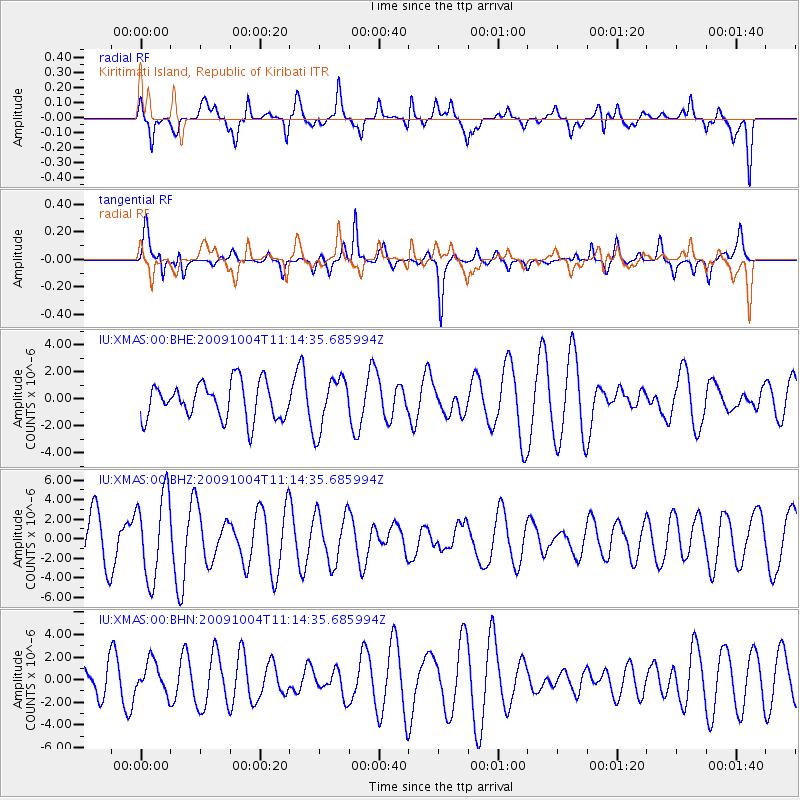
XMAS Kiritimati Island, Republic of Kiribati - Earthquake Result Viewer
*The percent match for this event was below the threshold and hence no stack was calculated.
| Earthquake location: |
Mindanao, Philippines |
| Earthquake latitude/longitude: |
6.7/123.5 |
| Earthquake time(UTC): |
2009/10/04 (277) 11:04:07 GMT |
| Earthquake Depth: |
640 km |
| Earthquake Magnitude: |
5.6 MB |
| Earthquake Catalog/Contributor: |
WHDF/NEIC |
|
| Network: |
IU Global Seismograph Network (GSN - IRIS/USGS) |
| Station: |
XMAS Kiritimati Island, Republic of Kiribati |
| Lat/Lon: |
2.04 N/157.45 W |
| Elevation: |
20 m |
|
| Distance: |
78.9 deg |
| Az: |
89.229 deg |
| Baz: |
276.368 deg |
| Ray Param: |
$rayparam |
*The percent match for this event was below the threshold and hence was not used in the summary stack. |
|
| Radial Match: |
57.816452 % |
| Radial Bump: |
400 |
| Transverse Match: |
64.5459 % |
| Transverse Bump: |
400 |
| SOD ConfigId: |
1 |
| Insert Time: |
2010-02-19 00:31:29.627 +0000 |
| GWidth: |
2.5 |
| Max Bumps: |
400 |
| Tol: |
0.001 |
|
Signal To Noise
| Channel | StoN | STA | LTA |
| IU:XMAS:00:BHZ:20091004T11:14:35.685994Z | 2.2502322 | 4.2954634E-6 | 1.9088977E-6 |
| IU:XMAS:00:BHN:20091004T11:14:35.685994Z | 1.2580649 | 1.4044607E-6 | 1.1163659E-6 |
| IU:XMAS:00:BHE:20091004T11:14:35.685994Z | 1.4463578 | 1.932562E-6 | 1.3361575E-6 |
| Arrivals |
| Ps | |
| PpPs | |
| PsPs/PpSs | |


