You are here: Home > Network List > IU - Global Seismograph Network (GSN - IRIS/USGS) Stations List
> Station CTAO Charters Towers, Australia > Earthquake Result Viewer
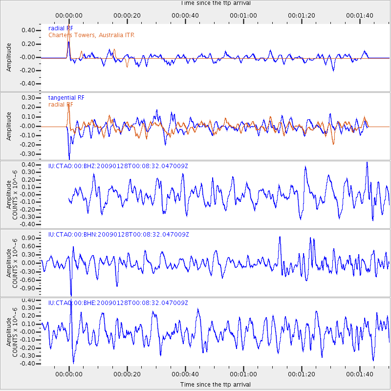
CTAO Charters Towers, Australia - Earthquake Result Viewer
*The percent match for this event was below the threshold and hence no stack was calculated.
| Earthquake location: |
Komandorskiye Ostrova Region |
| Earthquake latitude/longitude: |
55.5/164.3 |
| Earthquake time(UTC): |
2009/01/27 (027) 23:57:13 GMT |
| Earthquake Depth: |
24 km |
| Earthquake Magnitude: |
5.5 MW, 5.2 MS, 5.4 MB |
| Earthquake Catalog/Contributor: |
WHDF/NEIC |
|
| Network: |
IU Global Seismograph Network (GSN - IRIS/USGS) |
| Station: |
CTAO Charters Towers, Australia |
| Lat/Lon: |
20.09 S/146.25 E |
| Elevation: |
357 m |
|
| Distance: |
76.9 deg |
| Az: |
197.394 deg |
| Baz: |
10.417 deg |
| Ray Param: |
$rayparam |
*The percent match for this event was below the threshold and hence was not used in the summary stack. |
|
| Radial Match: |
56.07028 % |
| Radial Bump: |
361 |
| Transverse Match: |
64.38497 % |
| Transverse Bump: |
400 |
| SOD ConfigId: |
2658 |
| Insert Time: |
2010-03-03 14:36:30.652 +0000 |
| GWidth: |
2.5 |
| Max Bumps: |
400 |
| Tol: |
0.001 |
|
Signal To Noise
| Channel | StoN | STA | LTA |
| IU:CTAO:00:BHN:20090128T00:08:32.047009Z | 2.8874965 | 3.6230483E-7 | 1.2547369E-7 |
| IU:CTAO:00:BHE:20090128T00:08:32.047009Z | 2.0793 | 1.9461467E-7 | 9.359625E-8 |
| IU:CTAO:00:BHZ:20090128T00:08:32.047009Z | 1.4633342 | 1.5354212E-7 | 1.04926215E-7 |
| Arrivals |
| Ps | |
| PpPs | |
| PsPs/PpSs | |


