You are here: Home > Network List > IU - Global Seismograph Network (GSN - IRIS/USGS) Stations List
> Station CTAO Charters Towers, Australia > Earthquake Result Viewer
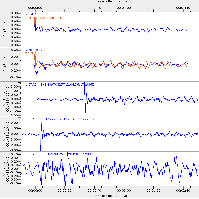
CTAO Charters Towers, Australia - Earthquake Result Viewer
*The percent match for this event was below the threshold and hence no stack was calculated.
| Earthquake location: |
Fiji Islands Region |
| Earthquake latitude/longitude: |
-20.8/-177.8 |
| Earthquake time(UTC): |
1997/08/25 (237) 11:59:00 GMT |
| Earthquake Depth: |
394 km |
| Earthquake Magnitude: |
5.5 UNKNOWN, 5.3 MB |
| Earthquake Catalog/Contributor: |
WHDF/NEIC |
|
| Network: |
IU Global Seismograph Network (GSN - IRIS/USGS) |
| Station: |
CTAO Charters Towers, Australia |
| Lat/Lon: |
20.09 S/146.25 E |
| Elevation: |
357 m |
|
| Distance: |
33.7 deg |
| Az: |
264.739 deg |
| Baz: |
97.601 deg |
| Ray Param: |
$rayparam |
*The percent match for this event was below the threshold and hence was not used in the summary stack. |
|
| Radial Match: |
50.387634 % |
| Radial Bump: |
398 |
| Transverse Match: |
72.43986 % |
| Transverse Bump: |
400 |
| SOD ConfigId: |
4480 |
| Insert Time: |
2010-03-03 14:36:33.142 +0000 |
| GWidth: |
2.5 |
| Max Bumps: |
400 |
| Tol: |
0.001 |
|
Signal To Noise
| Channel | StoN | STA | LTA |
| IU:CTAO: :BHN:19970825T12:04:36.172986Z | 5.3662853 | 7.888292E-7 | 1.4699725E-7 |
| IU:CTAO: :BHE:19970825T12:04:36.172986Z | 1.2356937 | 1.3589091E-7 | 1.0997135E-7 |
| IU:CTAO: :BHZ:19970825T12:04:36.172986Z | 6.023924 | 5.1129285E-7 | 8.4877044E-8 |
| Arrivals |
| Ps | |
| PpPs | |
| PsPs/PpSs | |


