You are here: Home > Network List > TA - USArray Transportable Network (new EarthScope stations) Stations List
> Station M04C Macdoel, CA, USA > Earthquake Result Viewer
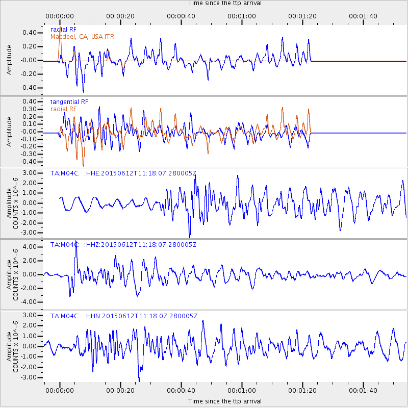
M04C Macdoel, CA, USA - Earthquake Result Viewer
*The percent match for this event was below the threshold and hence no stack was calculated.
| Earthquake location: |
Samoa Islands Region |
| Earthquake latitude/longitude: |
-15.6/-173.0 |
| Earthquake time(UTC): |
2015/06/12 (163) 11:07:04 GMT |
| Earthquake Depth: |
29 km |
| Earthquake Magnitude: |
6.3 MO |
| Earthquake Catalog/Contributor: |
NEIC PDE/NEIC ALERT |
|
| Network: |
TA USArray Transportable Network (new EarthScope stations) |
| Station: |
M04C Macdoel, CA, USA |
| Lat/Lon: |
41.78 N/121.84 W |
| Elevation: |
1391 m |
|
| Distance: |
74.1 deg |
| Az: |
37.288 deg |
| Baz: |
231.314 deg |
| Ray Param: |
$rayparam |
*The percent match for this event was below the threshold and hence was not used in the summary stack. |
|
| Radial Match: |
79.164665 % |
| Radial Bump: |
400 |
| Transverse Match: |
64.2471 % |
| Transverse Bump: |
400 |
| SOD ConfigId: |
7422571 |
| Insert Time: |
2019-04-19 07:58:34.503 +0000 |
| GWidth: |
2.5 |
| Max Bumps: |
400 |
| Tol: |
0.001 |
|
Signal To Noise
| Channel | StoN | STA | LTA |
| TA:M04C: :HHZ:20150612T11:18:07.280005Z | 3.0848198 | 1.0781736E-6 | 3.4950943E-7 |
| TA:M04C: :HHN:20150612T11:18:07.280005Z | 0.3864592 | 1.7112127E-7 | 4.4279258E-7 |
| TA:M04C: :HHE:20150612T11:18:07.280005Z | 0.9678409 | 4.1325256E-7 | 4.2698397E-7 |
| Arrivals |
| Ps | |
| PpPs | |
| PsPs/PpSs | |


