You are here: Home > Network List > IU - Global Seismograph Network (GSN - IRIS/USGS) Stations List
> Station CTAO Charters Towers, Australia > Earthquake Result Viewer
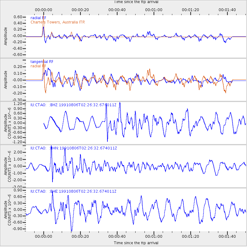
CTAO Charters Towers, Australia - Earthquake Result Viewer
*The percent match for this event was below the threshold and hence no stack was calculated.
| Earthquake location: |
Off W Coast Of Northern Sumatra |
| Earthquake latitude/longitude: |
3.8/95.4 |
| Earthquake time(UTC): |
1991/08/06 (218) 02:17:32 GMT |
| Earthquake Depth: |
25 km |
| Earthquake Magnitude: |
6.0 MB, 5.4 MS |
| Earthquake Catalog/Contributor: |
WHDF/NEIC |
|
| Network: |
IU Global Seismograph Network (GSN - IRIS/USGS) |
| Station: |
CTAO Charters Towers, Australia |
| Lat/Lon: |
20.09 S/146.25 E |
| Elevation: |
357 m |
|
| Distance: |
55.3 deg |
| Az: |
117.526 deg |
| Baz: |
289.703 deg |
| Ray Param: |
$rayparam |
*The percent match for this event was below the threshold and hence was not used in the summary stack. |
|
| Radial Match: |
66.816345 % |
| Radial Bump: |
400 |
| Transverse Match: |
72.31487 % |
| Transverse Bump: |
400 |
| SOD ConfigId: |
4480 |
| Insert Time: |
2010-03-03 14:36:51.738 +0000 |
| GWidth: |
2.5 |
| Max Bumps: |
400 |
| Tol: |
0.001 |
|
Signal To Noise
| Channel | StoN | STA | LTA |
| IU:CTAO: :BHN:19910806T02:26:32.674011Z | 3.424797 | 9.940422E-7 | 2.9024852E-7 |
| IU:CTAO: :BHE:19910806T02:26:32.674011Z | 1.0653722 | 2.2899744E-7 | 2.1494594E-7 |
| IU:CTAO: :BHZ:19910806T02:26:32.674011Z | 1.4079355 | 4.4903157E-7 | 3.189291E-7 |
| Arrivals |
| Ps | |
| PpPs | |
| PsPs/PpSs | |


