You are here: Home > Network List > G - GEOSCOPE Stations List
> Station MPG Montagne des Peres, French Guyana > Earthquake Result Viewer
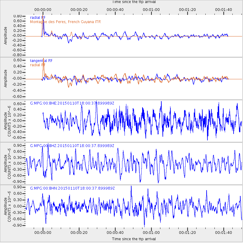
MPG Montagne des Peres, French Guyana - Earthquake Result Viewer
*The percent match for this event was below the threshold and hence no stack was calculated.
| Earthquake location: |
Chile-Bolivia Border Region |
| Earthquake latitude/longitude: |
-21.6/-68.5 |
| Earthquake time(UTC): |
2015/01/10 (010) 17:55:02 GMT |
| Earthquake Depth: |
109 km |
| Earthquake Magnitude: |
5.5 MWW, 5.4 MWR, 5.5 MWB |
| Earthquake Catalog/Contributor: |
NEIC PDE/NEIC COMCAT |
|
| Network: |
G GEOSCOPE |
| Station: |
MPG Montagne des Peres, French Guyana |
| Lat/Lon: |
5.11 N/52.64 W |
| Elevation: |
147 m |
|
| Distance: |
30.8 deg |
| Az: |
32.177 deg |
| Baz: |
209.83 deg |
| Ray Param: |
$rayparam |
*The percent match for this event was below the threshold and hence was not used in the summary stack. |
|
| Radial Match: |
61.85549 % |
| Radial Bump: |
400 |
| Transverse Match: |
47.136494 % |
| Transverse Bump: |
400 |
| SOD ConfigId: |
837871 |
| Insert Time: |
2015-02-12 22:00:38.161 +0000 |
| GWidth: |
2.5 |
| Max Bumps: |
400 |
| Tol: |
0.001 |
|
Signal To Noise
| Channel | StoN | STA | LTA |
| G:MPG:00:BHZ:20150110T18:00:37.899989Z | 2.1486695 | 5.019401E-7 | 2.336051E-7 |
| G:MPG:00:BHN:20150110T18:00:37.899989Z | 1.5531877 | 3.3121978E-7 | 2.1325161E-7 |
| G:MPG:00:BHE:20150110T18:00:37.899989Z | 1.6089672 | 2.992108E-7 | 1.8596451E-7 |
| Arrivals |
| Ps | |
| PpPs | |
| PsPs/PpSs | |


