You are here: Home > Network List > IU - Global Seismograph Network (GSN - IRIS/USGS) Stations List
> Station CTAO Charters Towers, Australia > Earthquake Result Viewer
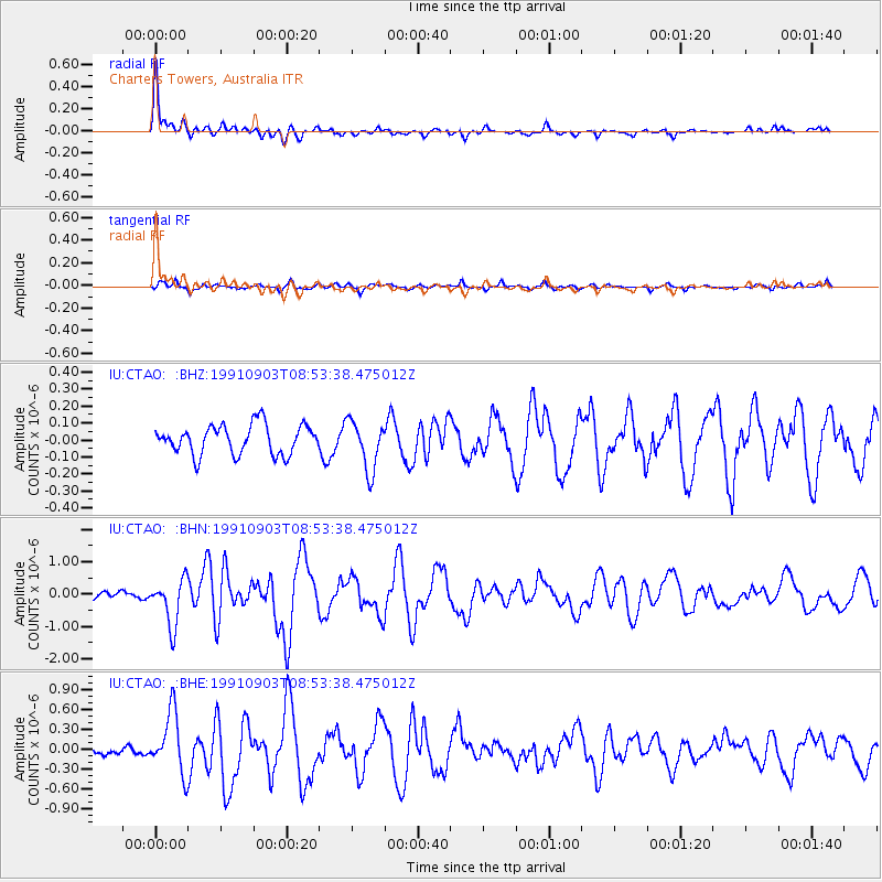
CTAO Charters Towers, Australia - Earthquake Result Viewer
*The percent match for this event was below the threshold and hence no stack was calculated.
| Earthquake location: |
Southeast Of Honshu, Japan |
| Earthquake latitude/longitude: |
33.6/138.8 |
| Earthquake time(UTC): |
1991/09/03 (246) 08:44:47 GMT |
| Earthquake Depth: |
23 km |
| Earthquake Magnitude: |
5.9 MB, 6.4 MS, 6.0 UNKNOWN |
| Earthquake Catalog/Contributor: |
WHDF/NEIC |
|
| Network: |
IU Global Seismograph Network (GSN - IRIS/USGS) |
| Station: |
CTAO Charters Towers, Australia |
| Lat/Lon: |
20.09 S/146.25 E |
| Elevation: |
357 m |
|
| Distance: |
53.9 deg |
| Az: |
171.297 deg |
| Baz: |
352.282 deg |
| Ray Param: |
$rayparam |
*The percent match for this event was below the threshold and hence was not used in the summary stack. |
|
| Radial Match: |
76.614815 % |
| Radial Bump: |
365 |
| Transverse Match: |
67.384705 % |
| Transverse Bump: |
400 |
| SOD ConfigId: |
4480 |
| Insert Time: |
2010-03-03 14:36:55.450 +0000 |
| GWidth: |
2.5 |
| Max Bumps: |
400 |
| Tol: |
0.001 |
|
Signal To Noise
| Channel | StoN | STA | LTA |
| IU:CTAO: :BHN:19910903T08:53:38.475012Z | 4.098265 | 7.2426565E-7 | 1.7672494E-7 |
| IU:CTAO: :BHE:19910903T08:53:38.475012Z | 3.3381057 | 4.5965052E-7 | 1.3769801E-7 |
| IU:CTAO: :BHZ:19910903T08:53:38.475012Z | 1.7010154 | 1.4611601E-7 | 8.5899295E-8 |
| Arrivals |
| Ps | |
| PpPs | |
| PsPs/PpSs | |


