You are here: Home > Network List > UW - Pacific Northwest Regional Seismic Network Stations List
> Station PASS Maple Falls, WA, USA > Earthquake Result Viewer
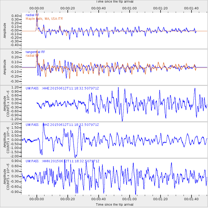
PASS Maple Falls, WA, USA - Earthquake Result Viewer
*The percent match for this event was below the threshold and hence no stack was calculated.
| Earthquake location: |
Samoa Islands Region |
| Earthquake latitude/longitude: |
-15.6/-173.0 |
| Earthquake time(UTC): |
2015/06/12 (163) 11:07:04 GMT |
| Earthquake Depth: |
29 km |
| Earthquake Magnitude: |
6.3 MO |
| Earthquake Catalog/Contributor: |
NEIC PDE/NEIC ALERT |
|
| Network: |
UW Pacific Northwest Regional Seismic Network |
| Station: |
PASS Maple Falls, WA, USA |
| Lat/Lon: |
49.00 N/122.09 W |
| Elevation: |
174 m |
|
| Distance: |
78.5 deg |
| Az: |
31.441 deg |
| Baz: |
229.751 deg |
| Ray Param: |
$rayparam |
*The percent match for this event was below the threshold and hence was not used in the summary stack. |
|
| Radial Match: |
77.19747 % |
| Radial Bump: |
400 |
| Transverse Match: |
73.16254 % |
| Transverse Bump: |
400 |
| SOD ConfigId: |
7422571 |
| Insert Time: |
2019-04-19 08:00:10.786 +0000 |
| GWidth: |
2.5 |
| Max Bumps: |
400 |
| Tol: |
0.001 |
|
Signal To Noise
| Channel | StoN | STA | LTA |
| UW:PASS: :HHZ:20150612T11:18:32.507971Z | 6.688993 | 1.0309147E-6 | 1.5412107E-7 |
| UW:PASS: :HHN:20150612T11:18:32.507971Z | 1.5749788 | 2.2304897E-7 | 1.4162029E-7 |
| UW:PASS: :HHE:20150612T11:18:32.507971Z | 2.7266788 | 3.6374152E-7 | 1.3340093E-7 |
| Arrivals |
| Ps | |
| PpPs | |
| PsPs/PpSs | |


