You are here: Home > Network List > IU - Global Seismograph Network (GSN - IRIS/USGS) Stations List
> Station CTAO Charters Towers, Australia > Earthquake Result Viewer
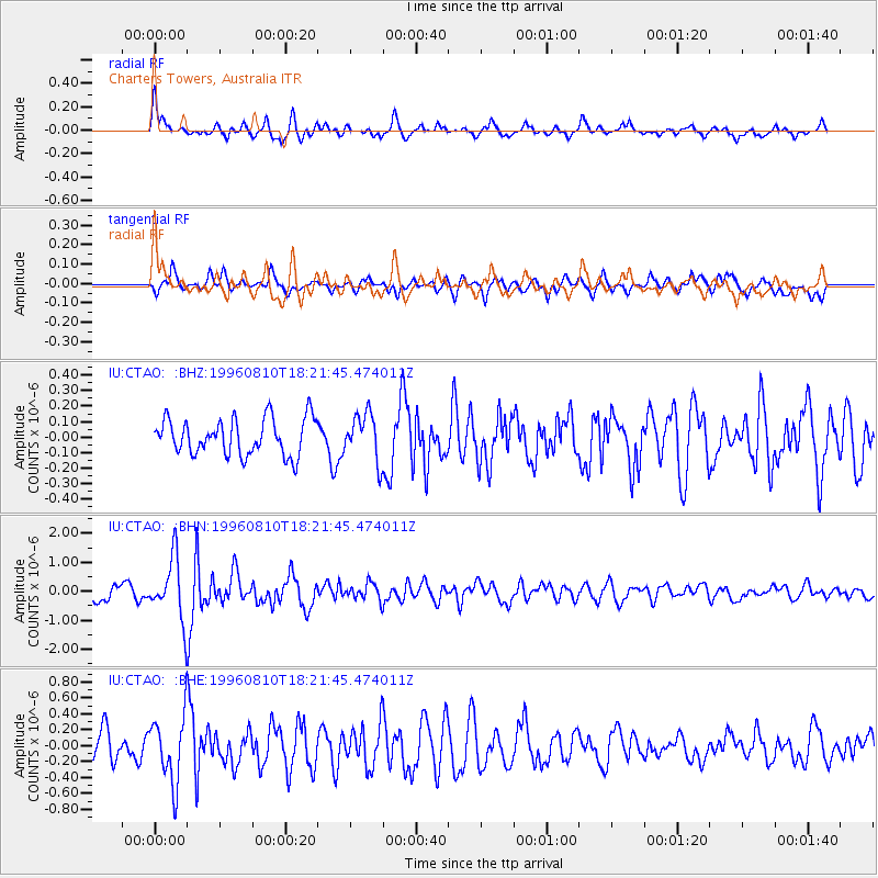
CTAO Charters Towers, Australia - Earthquake Result Viewer
*The percent match for this event was below the threshold and hence no stack was calculated.
| Earthquake location: |
Eastern Honshu, Japan |
| Earthquake latitude/longitude: |
38.9/140.5 |
| Earthquake time(UTC): |
1996/08/10 (223) 18:12:17 GMT |
| Earthquake Depth: |
10 km |
| Earthquake Magnitude: |
6.0 MB, 5.7 MS, 5.9 UNKNOWN, 5.9 MW |
| Earthquake Catalog/Contributor: |
WHDF/NEIC |
|
| Network: |
IU Global Seismograph Network (GSN - IRIS/USGS) |
| Station: |
CTAO Charters Towers, Australia |
| Lat/Lon: |
20.09 S/146.25 E |
| Elevation: |
357 m |
|
| Distance: |
58.9 deg |
| Az: |
173.716 deg |
| Baz: |
354.787 deg |
| Ray Param: |
$rayparam |
*The percent match for this event was below the threshold and hence was not used in the summary stack. |
|
| Radial Match: |
63.833447 % |
| Radial Bump: |
400 |
| Transverse Match: |
62.17454 % |
| Transverse Bump: |
400 |
| SOD ConfigId: |
4480 |
| Insert Time: |
2010-03-03 14:37:02.630 +0000 |
| GWidth: |
2.5 |
| Max Bumps: |
400 |
| Tol: |
0.001 |
|
Signal To Noise
| Channel | StoN | STA | LTA |
| IU:CTAO: :BHN:19960810T18:21:45.474011Z | 3.5475483 | 1.0481824E-6 | 2.954667E-7 |
| IU:CTAO: :BHE:19960810T18:21:45.474011Z | 1.803023 | 4.0960705E-7 | 2.2717794E-7 |
| IU:CTAO: :BHZ:19960810T18:21:45.474011Z | 1.2900918 | 1.5094986E-7 | 1.1700707E-7 |
| Arrivals |
| Ps | |
| PpPs | |
| PsPs/PpSs | |


