You are here: Home > Network List > IU - Global Seismograph Network (GSN - IRIS/USGS) Stations List
> Station CTAO Charters Towers, Australia > Earthquake Result Viewer
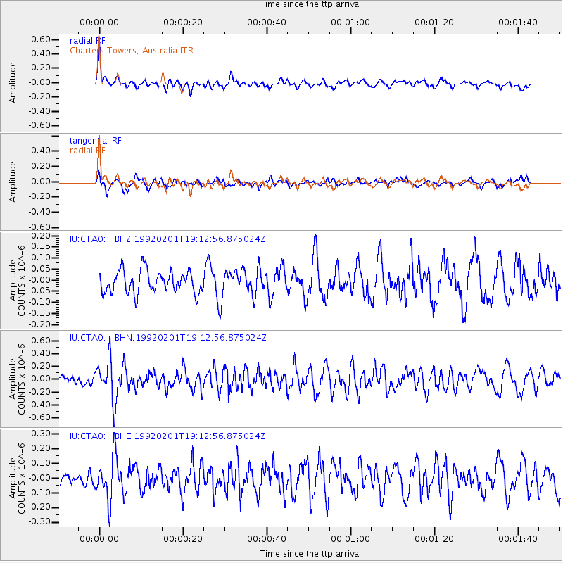
CTAO Charters Towers, Australia - Earthquake Result Viewer
*The percent match for this event was below the threshold and hence no stack was calculated.
| Earthquake location: |
Near S. Coast Of Honshu, Japan |
| Earthquake latitude/longitude: |
35.1/139.7 |
| Earthquake time(UTC): |
1992/02/01 (032) 19:04:05 GMT |
| Earthquake Depth: |
105 km |
| Earthquake Magnitude: |
5.6 MB |
| Earthquake Catalog/Contributor: |
WHDF/NEIC |
|
| Network: |
IU Global Seismograph Network (GSN - IRIS/USGS) |
| Station: |
CTAO Charters Towers, Australia |
| Lat/Lon: |
20.09 S/146.25 E |
| Elevation: |
357 m |
|
| Distance: |
55.3 deg |
| Az: |
172.455 deg |
| Baz: |
353.424 deg |
| Ray Param: |
$rayparam |
*The percent match for this event was below the threshold and hence was not used in the summary stack. |
|
| Radial Match: |
74.19369 % |
| Radial Bump: |
400 |
| Transverse Match: |
51.317753 % |
| Transverse Bump: |
400 |
| SOD ConfigId: |
4480 |
| Insert Time: |
2010-03-03 14:37:17.594 +0000 |
| GWidth: |
2.5 |
| Max Bumps: |
400 |
| Tol: |
0.001 |
|
Signal To Noise
| Channel | StoN | STA | LTA |
| IU:CTAO: :BHN:19920201T19:12:56.875024Z | 2.9961798 | 3.1678707E-7 | 1.0573032E-7 |
| IU:CTAO: :BHE:19920201T19:12:56.875024Z | 1.879685 | 1.5056513E-7 | 8.010126E-8 |
| IU:CTAO: :BHZ:19920201T19:12:56.875024Z | 1.1859485 | 5.869773E-8 | 4.9494332E-8 |
| Arrivals |
| Ps | |
| PpPs | |
| PsPs/PpSs | |


