You are here: Home > Network List > IU - Global Seismograph Network (GSN - IRIS/USGS) Stations List
> Station CTAO Charters Towers, Australia > Earthquake Result Viewer
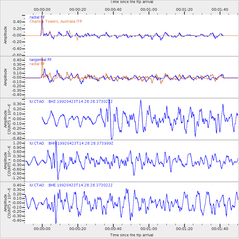
CTAO Charters Towers, Australia - Earthquake Result Viewer
*The percent match for this event was below the threshold and hence no stack was calculated.
| Earthquake location: |
Myanmar-China Border Region |
| Earthquake latitude/longitude: |
22.3/98.8 |
| Earthquake time(UTC): |
1992/04/23 (114) 14:18:37 GMT |
| Earthquake Depth: |
31 km |
| Earthquake Magnitude: |
5.8 MB, 6.1 MS |
| Earthquake Catalog/Contributor: |
WHDF/NEIC |
|
| Network: |
IU Global Seismograph Network (GSN - IRIS/USGS) |
| Station: |
CTAO Charters Towers, Australia |
| Lat/Lon: |
20.09 S/146.25 E |
| Elevation: |
357 m |
|
| Distance: |
62.6 deg |
| Az: |
128.808 deg |
| Baz: |
309.863 deg |
| Ray Param: |
$rayparam |
*The percent match for this event was below the threshold and hence was not used in the summary stack. |
|
| Radial Match: |
69.23269 % |
| Radial Bump: |
340 |
| Transverse Match: |
71.69647 % |
| Transverse Bump: |
400 |
| SOD ConfigId: |
4480 |
| Insert Time: |
2010-03-03 14:37:28.065 +0000 |
| GWidth: |
2.5 |
| Max Bumps: |
400 |
| Tol: |
0.001 |
|
Signal To Noise
| Channel | StoN | STA | LTA |
| IU:CTAO: :BHN:19920423T14:28:28.373999Z | 2.5529747 | 2.9078004E-7 | 1.1389852E-7 |
| IU:CTAO: :BHE:19920423T14:28:28.373022Z | 0.61311615 | 7.310861E-8 | 1.1924104E-7 |
| IU:CTAO: :BHZ:19920423T14:28:28.373022Z | 1.1634122 | 9.034991E-8 | 7.7659415E-8 |
| Arrivals |
| Ps | |
| PpPs | |
| PsPs/PpSs | |


