You are here: Home > Network List > IU - Global Seismograph Network (GSN - IRIS/USGS) Stations List
> Station CTAO Charters Towers, Australia > Earthquake Result Viewer
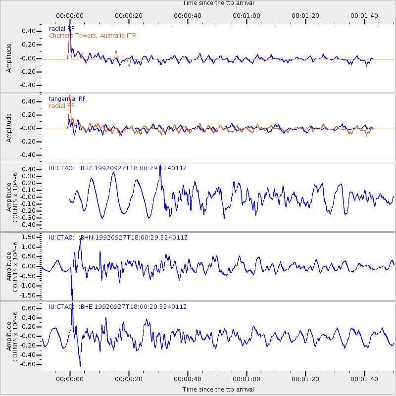
CTAO Charters Towers, Australia - Earthquake Result Viewer
*The percent match for this event was below the threshold and hence no stack was calculated.
| Earthquake location: |
South Of Alaska |
| Earthquake latitude/longitude: |
54.0/-157.3 |
| Earthquake time(UTC): |
1992/09/27 (271) 17:48:12 GMT |
| Earthquake Depth: |
33 km |
| Earthquake Magnitude: |
5.7 MB, 5.3 MS, 5.5 ML |
| Earthquake Catalog/Contributor: |
WHDF/NEIC |
|
| Network: |
IU Global Seismograph Network (GSN - IRIS/USGS) |
| Station: |
CTAO Charters Towers, Australia |
| Lat/Lon: |
20.09 S/146.25 E |
| Elevation: |
357 m |
|
| Distance: |
88.2 deg |
| Az: |
231.596 deg |
| Baz: |
29.522 deg |
| Ray Param: |
$rayparam |
*The percent match for this event was below the threshold and hence was not used in the summary stack. |
|
| Radial Match: |
59.505726 % |
| Radial Bump: |
374 |
| Transverse Match: |
40.69691 % |
| Transverse Bump: |
400 |
| SOD ConfigId: |
4480 |
| Insert Time: |
2010-03-03 14:37:41.031 +0000 |
| GWidth: |
2.5 |
| Max Bumps: |
400 |
| Tol: |
0.001 |
|
Signal To Noise
| Channel | StoN | STA | LTA |
| IU:CTAO: :BHN:19920927T18:00:29.324011Z | 4.7096586 | 6.536896E-7 | 1.3879767E-7 |
| IU:CTAO: :BHE:19920927T18:00:29.324011Z | 2.675129 | 2.8567564E-7 | 1.0678949E-7 |
| IU:CTAO: :BHZ:19920927T18:00:29.324011Z | 1.162457 | 2.0059167E-7 | 1.7255836E-7 |
| Arrivals |
| Ps | |
| PpPs | |
| PsPs/PpSs | |


