You are here: Home > Network List > IU - Global Seismograph Network (GSN - IRIS/USGS) Stations List
> Station CTAO Charters Towers, Australia > Earthquake Result Viewer
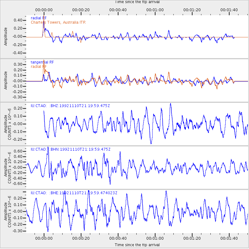
CTAO Charters Towers, Australia - Earthquake Result Viewer
*The percent match for this event was below the threshold and hence no stack was calculated.
| Earthquake location: |
Near East Coast Of Kamchatka |
| Earthquake latitude/longitude: |
53.9/160.8 |
| Earthquake time(UTC): |
1992/11/10 (315) 21:08:54 GMT |
| Earthquake Depth: |
33 km |
| Earthquake Magnitude: |
5.6 MB, 5.3 MS |
| Earthquake Catalog/Contributor: |
WHDF/NEIC |
|
| Network: |
IU Global Seismograph Network (GSN - IRIS/USGS) |
| Station: |
CTAO Charters Towers, Australia |
| Lat/Lon: |
20.09 S/146.25 E |
| Elevation: |
357 m |
|
| Distance: |
74.7 deg |
| Az: |
194.13 deg |
| Baz: |
8.848 deg |
| Ray Param: |
$rayparam |
*The percent match for this event was below the threshold and hence was not used in the summary stack. |
|
| Radial Match: |
64.99868 % |
| Radial Bump: |
400 |
| Transverse Match: |
59.657238 % |
| Transverse Bump: |
400 |
| SOD ConfigId: |
4480 |
| Insert Time: |
2010-03-03 14:37:42.999 +0000 |
| GWidth: |
2.5 |
| Max Bumps: |
400 |
| Tol: |
0.001 |
|
Signal To Noise
| Channel | StoN | STA | LTA |
| IU:CTAO: :BHN:19921110T21:19:59.475Z | 3.058265 | 3.5406194E-7 | 1.1577217E-7 |
| IU:CTAO: :BHE:19921110T21:19:59.474023Z | 1.7268002 | 1.3497113E-7 | 7.8162564E-8 |
| IU:CTAO: :BHZ:19921110T21:19:59.475Z | 1.2725824 | 8.633707E-8 | 6.784399E-8 |
| Arrivals |
| Ps | |
| PpPs | |
| PsPs/PpSs | |


