You are here: Home > Network List > IU - Global Seismograph Network (GSN - IRIS/USGS) Stations List
> Station CTAO Charters Towers, Australia > Earthquake Result Viewer
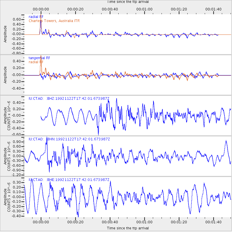
CTAO Charters Towers, Australia - Earthquake Result Viewer
*The percent match for this event was below the threshold and hence no stack was calculated.
| Earthquake location: |
Tonga Islands |
| Earthquake latitude/longitude: |
-19.6/-173.8 |
| Earthquake time(UTC): |
1992/11/22 (327) 17:35:19 GMT |
| Earthquake Depth: |
20 km |
| Earthquake Magnitude: |
5.5 MB, 5.4 MS |
| Earthquake Catalog/Contributor: |
WHDF/NEIC |
|
| Network: |
IU Global Seismograph Network (GSN - IRIS/USGS) |
| Station: |
CTAO Charters Towers, Australia |
| Lat/Lon: |
20.09 S/146.25 E |
| Elevation: |
357 m |
|
| Distance: |
37.5 deg |
| Az: |
262.302 deg |
| Baz: |
96.287 deg |
| Ray Param: |
$rayparam |
*The percent match for this event was below the threshold and hence was not used in the summary stack. |
|
| Radial Match: |
67.95311 % |
| Radial Bump: |
298 |
| Transverse Match: |
52.941296 % |
| Transverse Bump: |
400 |
| SOD ConfigId: |
4480 |
| Insert Time: |
2010-03-03 14:37:43.845 +0000 |
| GWidth: |
2.5 |
| Max Bumps: |
400 |
| Tol: |
0.001 |
|
Signal To Noise
| Channel | StoN | STA | LTA |
| IU:CTAO: :BHN:19921122T17:42:01.673987Z | 1.7289859 | 4.7161942E-7 | 2.7277227E-7 |
| IU:CTAO: :BHE:19921122T17:42:01.673987Z | 1.3074799 | 1.8419233E-7 | 1.4087584E-7 |
| IU:CTAO: :BHZ:19921122T17:42:01.673987Z | 1.321155 | 2.1054417E-7 | 1.5936372E-7 |
| Arrivals |
| Ps | |
| PpPs | |
| PsPs/PpSs | |


