You are here: Home > Network List > UU - University of Utah Regional Network Stations List
> Station CCUT Cedar City, UT, USA > Earthquake Result Viewer
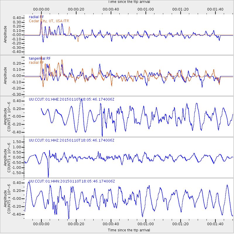
CCUT Cedar City, UT, USA - Earthquake Result Viewer
*The percent match for this event was below the threshold and hence no stack was calculated.
| Earthquake location: |
Chile-Bolivia Border Region |
| Earthquake latitude/longitude: |
-21.6/-68.5 |
| Earthquake time(UTC): |
2015/01/10 (010) 17:55:02 GMT |
| Earthquake Depth: |
109 km |
| Earthquake Magnitude: |
5.5 MWW, 5.4 MWR, 5.5 MWB |
| Earthquake Catalog/Contributor: |
NEIC PDE/NEIC COMCAT |
|
| Network: |
UU University of Utah Regional Network |
| Station: |
CCUT Cedar City, UT, USA |
| Lat/Lon: |
37.55 N/113.36 W |
| Elevation: |
2127 m |
|
| Distance: |
72.4 deg |
| Az: |
324.001 deg |
| Baz: |
136.523 deg |
| Ray Param: |
$rayparam |
*The percent match for this event was below the threshold and hence was not used in the summary stack. |
|
| Radial Match: |
56.081024 % |
| Radial Bump: |
400 |
| Transverse Match: |
59.32885 % |
| Transverse Bump: |
400 |
| SOD ConfigId: |
837871 |
| Insert Time: |
2015-02-12 22:05:57.207 +0000 |
| GWidth: |
2.5 |
| Max Bumps: |
400 |
| Tol: |
0.001 |
|
Signal To Noise
| Channel | StoN | STA | LTA |
| UU:CCUT:01:HHZ:20150110T18:05:46.174006Z | 2.2548516 | 6.1560706E-7 | 2.7301448E-7 |
| UU:CCUT:01:HHN:20150110T18:05:46.174006Z | 0.72495145 | 1.6730533E-7 | 2.3078144E-7 |
| UU:CCUT:01:HHE:20150110T18:05:46.174006Z | 0.734214 | 1.3577562E-7 | 1.849265E-7 |
| Arrivals |
| Ps | |
| PpPs | |
| PsPs/PpSs | |


