You are here: Home > Network List > TA - USArray Transportable Network (new EarthScope stations) Stations List
> Station A21K Barrow, AK, USA > Earthquake Result Viewer
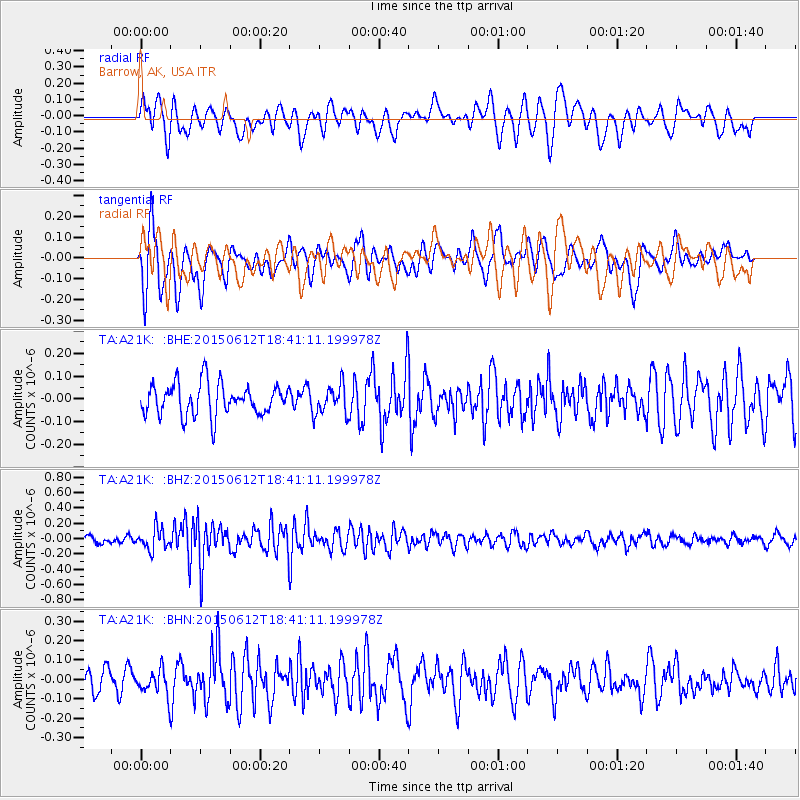
A21K Barrow, AK, USA - Earthquake Result Viewer
*The percent match for this event was below the threshold and hence no stack was calculated.
| Earthquake location: |
Borneo |
| Earthquake latitude/longitude: |
6.1/116.6 |
| Earthquake time(UTC): |
2015/06/12 (163) 18:29:18 GMT |
| Earthquake Depth: |
28 km |
| Earthquake Magnitude: |
5.2 MW |
| Earthquake Catalog/Contributor: |
ISC/ISC |
|
| Network: |
TA USArray Transportable Network (new EarthScope stations) |
| Station: |
A21K Barrow, AK, USA |
| Lat/Lon: |
71.32 N/156.62 W |
| Elevation: |
577 m |
|
| Distance: |
83.3 deg |
| Az: |
18.9 deg |
| Baz: |
268.883 deg |
| Ray Param: |
$rayparam |
*The percent match for this event was below the threshold and hence was not used in the summary stack. |
|
| Radial Match: |
61.92256 % |
| Radial Bump: |
400 |
| Transverse Match: |
61.060547 % |
| Transverse Bump: |
400 |
| SOD ConfigId: |
7422571 |
| Insert Time: |
2019-04-19 08:10:24.862 +0000 |
| GWidth: |
2.5 |
| Max Bumps: |
400 |
| Tol: |
0.001 |
|
Signal To Noise
| Channel | StoN | STA | LTA |
| TA:A21K: :BHZ:20150612T18:41:11.199978Z | 1.6107627 | 1.3758489E-7 | 8.541599E-8 |
| TA:A21K: :BHN:20150612T18:41:11.199978Z | 0.7138327 | 6.424045E-8 | 8.999372E-8 |
| TA:A21K: :BHE:20150612T18:41:11.199978Z | 0.93026406 | 6.457156E-8 | 6.9412074E-8 |
| Arrivals |
| Ps | |
| PpPs | |
| PsPs/PpSs | |


