You are here: Home > Network List > IU - Global Seismograph Network (GSN - IRIS/USGS) Stations List
> Station CTAO Charters Towers, Australia > Earthquake Result Viewer
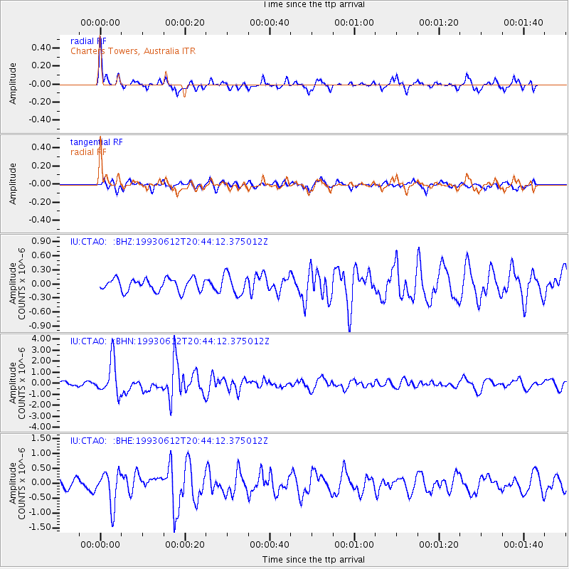
CTAO Charters Towers, Australia - Earthquake Result Viewer
*The percent match for this event was below the threshold and hence no stack was calculated.
| Earthquake location: |
Near East Coast Of Kamchatka |
| Earthquake latitude/longitude: |
51.2/157.7 |
| Earthquake time(UTC): |
1993/06/12 (163) 20:33:26 GMT |
| Earthquake Depth: |
49 km |
| Earthquake Magnitude: |
6.0 MB, 5.9 MS, 5.5 UNKNOWN, 6.3 MW |
| Earthquake Catalog/Contributor: |
WHDF/NEIC |
|
| Network: |
IU Global Seismograph Network (GSN - IRIS/USGS) |
| Station: |
CTAO Charters Towers, Australia |
| Lat/Lon: |
20.09 S/146.25 E |
| Elevation: |
357 m |
|
| Distance: |
71.7 deg |
| Az: |
191.374 deg |
| Baz: |
7.581 deg |
| Ray Param: |
$rayparam |
*The percent match for this event was below the threshold and hence was not used in the summary stack. |
|
| Radial Match: |
76.008865 % |
| Radial Bump: |
380 |
| Transverse Match: |
62.91955 % |
| Transverse Bump: |
399 |
| SOD ConfigId: |
4480 |
| Insert Time: |
2010-03-03 14:38:01.428 +0000 |
| GWidth: |
2.5 |
| Max Bumps: |
400 |
| Tol: |
0.001 |
|
Signal To Noise
| Channel | StoN | STA | LTA |
| IU:CTAO: :BHN:19930612T20:44:12.375012Z | 11.801532 | 1.6141518E-6 | 1.3677477E-7 |
| IU:CTAO: :BHE:19930612T20:44:12.375012Z | 4.229919 | 5.764086E-7 | 1.362694E-7 |
| IU:CTAO: :BHZ:19930612T20:44:12.375012Z | 1.682335 | 2.189301E-7 | 1.3013467E-7 |
| Arrivals |
| Ps | |
| PpPs | |
| PsPs/PpSs | |


