You are here: Home > Network List > IU - Global Seismograph Network (GSN - IRIS/USGS) Stations List
> Station RSSD Black Hills, South Dakota, USA > Earthquake Result Viewer
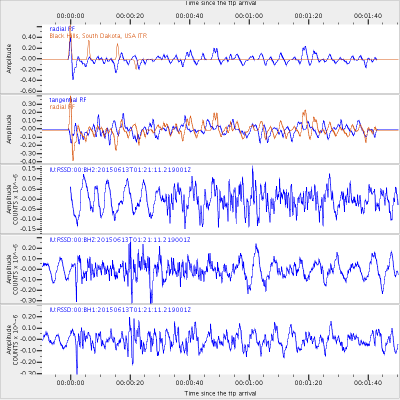
RSSD Black Hills, South Dakota, USA - Earthquake Result Viewer
*The percent match for this event was below the threshold and hence no stack was calculated.
| Earthquake location: |
Alaska Peninsula |
| Earthquake latitude/longitude: |
56.6/-156.6 |
| Earthquake time(UTC): |
2015/06/13 (164) 01:14:56 GMT |
| Earthquake Depth: |
68 km |
| Earthquake Magnitude: |
4.9 MW |
| Earthquake Catalog/Contributor: |
ISC/ISC |
|
| Network: |
IU Global Seismograph Network (GSN - IRIS/USGS) |
| Station: |
RSSD Black Hills, South Dakota, USA |
| Lat/Lon: |
44.12 N/104.04 W |
| Elevation: |
2090 m |
|
| Distance: |
34.9 deg |
| Az: |
88.144 deg |
| Baz: |
309.938 deg |
| Ray Param: |
$rayparam |
*The percent match for this event was below the threshold and hence was not used in the summary stack. |
|
| Radial Match: |
59.902344 % |
| Radial Bump: |
400 |
| Transverse Match: |
52.582546 % |
| Transverse Bump: |
400 |
| SOD ConfigId: |
7422571 |
| Insert Time: |
2019-04-19 08:18:08.019 +0000 |
| GWidth: |
2.5 |
| Max Bumps: |
400 |
| Tol: |
0.001 |
|
Signal To Noise
| Channel | StoN | STA | LTA |
| IU:RSSD:00:BHZ:20150613T01:21:11.219001Z | 1.8643003 | 9.061769E-8 | 4.860681E-8 |
| IU:RSSD:00:BH1:20150613T01:21:11.219001Z | 2.01117 | 8.97663E-8 | 4.4633875E-8 |
| IU:RSSD:00:BH2:20150613T01:21:11.219001Z | 0.64258265 | 3.979081E-8 | 6.192326E-8 |
| Arrivals |
| Ps | |
| PpPs | |
| PsPs/PpSs | |


