GUMO Guam, Marianas Islands - Earthquake Result Viewer
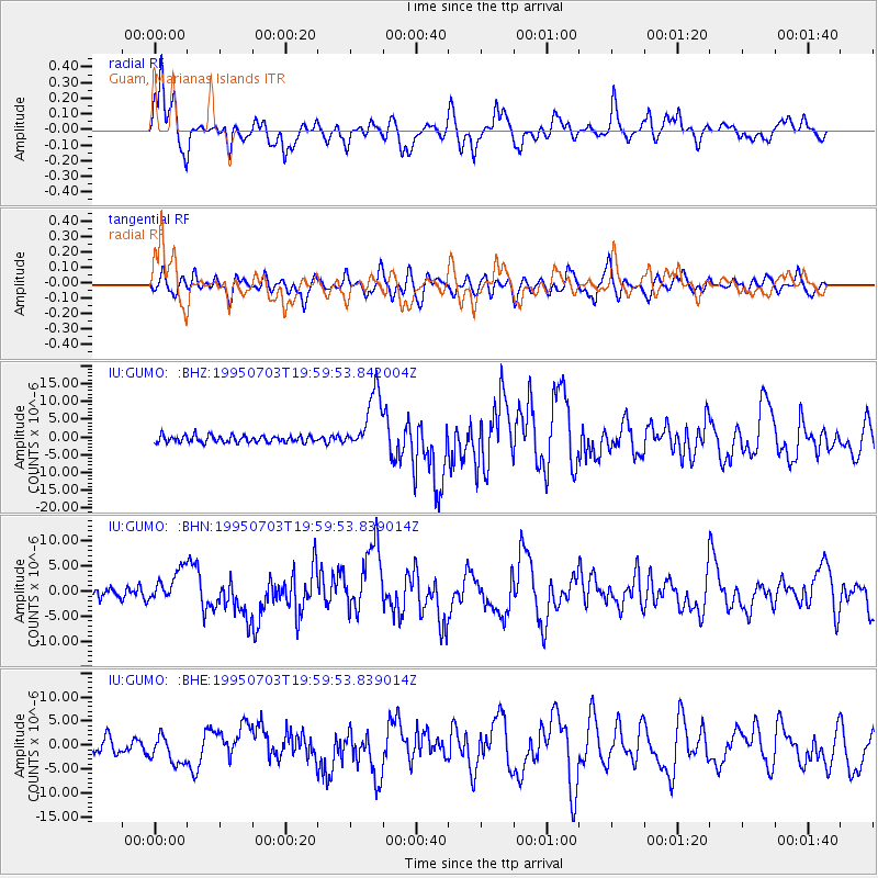
Earthquake location: Kermadec Islands, New Zealand
Earthquake latitude/longitude: -29.2/-177.6
Earthquake time(UTC): 1995/07/03 (184) 19:50:50 GMT
Earthquake Depth: 33 km
Earthquake Magnitude: 6.5 MB, 7.2 MS, 7.2 UNKNOWN, 7.2 MW
Earthquake Catalog/Contributor: WHDF/NEIC
Network: IU Global Seismograph Network (GSN - IRIS/USGS)
Station: GUMO Guam, Marianas Islands
Lat/Lon: 13.59 N/144.87 E
Elevation: 14 m
Distance: 55.9 deg
Az: 314.323 deg
Baz: 139.963 deg
Ray Param: 0.06444888
Estimated Moho Depth: 14.25 km
Estimated Crust Vp/Vs: 1.99
Assumed Crust Vp: 4.802 km/s
Estimated Crust Vs: 2.416 km/s
Estimated Crust Poisson's Ratio: 0.33
Radial Match: 85.68838 %
Radial Bump: 400
Transverse Match: 65.867256 %
Transverse Bump: 400
SOD ConfigId: 6273
Insert Time: 2010-03-03 14:38:54.262 +0000
GWidth: 2.5
Max Bumps: 400
Tol: 0.001

Signal To Noise

ChannelStoNSTALTA
IU:GUMO: :BHN:19950703T19:59:53.839014Z3.3266533.1683496E-69.524136E-7
IU:GUMO: :BHE:19950703T19:59:53.839014Z2.27514652.8864695E-61.2686961E-6
IU:GUMO: :BHZ:19950703T19:59:53.842004Z8.6393838.370832E-69.689154E-7
Arrivals
Ps3.0 SECOND
PpPs8.6 SECOND
PsPs/PpSs12 SECOND