You are here: Home > Network List > TA - USArray Transportable Network (new EarthScope stations) Stations List
> Station I61A Oroboro, Fairlee, VT, USA > Earthquake Result Viewer
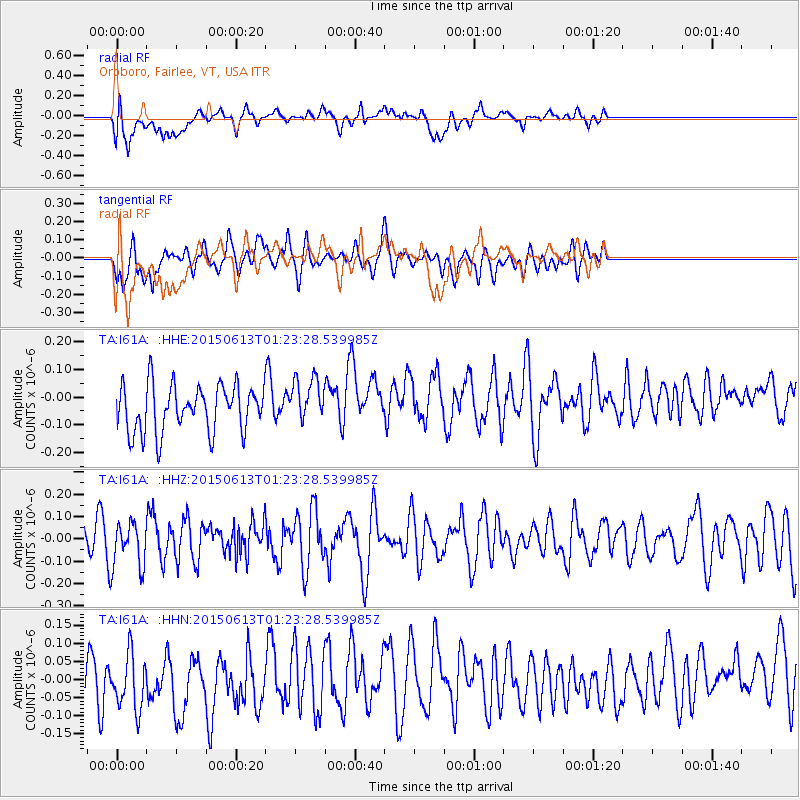
I61A Oroboro, Fairlee, VT, USA - Earthquake Result Viewer
*The percent match for this event was below the threshold and hence no stack was calculated.
| Earthquake location: |
Alaska Peninsula |
| Earthquake latitude/longitude: |
56.6/-156.6 |
| Earthquake time(UTC): |
2015/06/13 (164) 01:14:56 GMT |
| Earthquake Depth: |
68 km |
| Earthquake Magnitude: |
4.9 MW |
| Earthquake Catalog/Contributor: |
ISC/ISC |
|
| Network: |
TA USArray Transportable Network (new EarthScope stations) |
| Station: |
I61A Oroboro, Fairlee, VT, USA |
| Lat/Lon: |
43.93 N/72.21 W |
| Elevation: |
287 m |
|
| Distance: |
52.0 deg |
| Az: |
65.789 deg |
| Baz: |
315.777 deg |
| Ray Param: |
$rayparam |
*The percent match for this event was below the threshold and hence was not used in the summary stack. |
|
| Radial Match: |
52.157463 % |
| Radial Bump: |
400 |
| Transverse Match: |
52.085 % |
| Transverse Bump: |
400 |
| SOD ConfigId: |
7422571 |
| Insert Time: |
2019-04-19 08:21:17.191 +0000 |
| GWidth: |
2.5 |
| Max Bumps: |
400 |
| Tol: |
0.001 |
|
Signal To Noise
| Channel | StoN | STA | LTA |
| TA:I61A: :HHZ:20150613T01:23:28.539985Z | 0.909911 | 1.0080766E-7 | 1.1078849E-7 |
| TA:I61A: :HHN:20150613T01:23:28.539985Z | 1.5502026 | 9.0058414E-8 | 5.8094606E-8 |
| TA:I61A: :HHE:20150613T01:23:28.539985Z | 0.9632673 | 8.1220946E-8 | 8.431818E-8 |
| Arrivals |
| Ps | |
| PpPs | |
| PsPs/PpSs | |


