You are here: Home > Network List > TA - USArray Transportable Network (new EarthScope stations) Stations List
> Station W41B Gary Mavity, Velonia, AR, USA > Earthquake Result Viewer
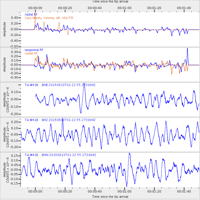
W41B Gary Mavity, Velonia, AR, USA - Earthquake Result Viewer
*The percent match for this event was below the threshold and hence no stack was calculated.
| Earthquake location: |
Alaska Peninsula |
| Earthquake latitude/longitude: |
56.6/-156.6 |
| Earthquake time(UTC): |
2015/06/13 (164) 01:14:56 GMT |
| Earthquake Depth: |
68 km |
| Earthquake Magnitude: |
4.9 MW |
| Earthquake Catalog/Contributor: |
ISC/ISC |
|
| Network: |
TA USArray Transportable Network (new EarthScope stations) |
| Station: |
W41B Gary Mavity, Velonia, AR, USA |
| Lat/Lon: |
35.17 N/92.25 W |
| Elevation: |
95 m |
|
| Distance: |
47.6 deg |
| Az: |
88.335 deg |
| Baz: |
317.614 deg |
| Ray Param: |
$rayparam |
*The percent match for this event was below the threshold and hence was not used in the summary stack. |
|
| Radial Match: |
47.890312 % |
| Radial Bump: |
400 |
| Transverse Match: |
54.671375 % |
| Transverse Bump: |
400 |
| SOD ConfigId: |
7422571 |
| Insert Time: |
2019-04-19 08:21:32.259 +0000 |
| GWidth: |
2.5 |
| Max Bumps: |
400 |
| Tol: |
0.001 |
|
Signal To Noise
| Channel | StoN | STA | LTA |
| TA:W41B: :BHZ:20150613T01:22:55.273994Z | 1.1184058 | 8.3932484E-8 | 7.504654E-8 |
| TA:W41B: :BHN:20150613T01:22:55.273994Z | 1.4548192 | 5.0537047E-8 | 3.473768E-8 |
| TA:W41B: :BHE:20150613T01:22:55.273994Z | 2.9771056 | 1.2275292E-7 | 4.1232305E-8 |
| Arrivals |
| Ps | |
| PpPs | |
| PsPs/PpSs | |


