You are here: Home > Network List > AZ - ANZA Regional Network Stations List
> Station SMER AZ.SMER > Earthquake Result Viewer
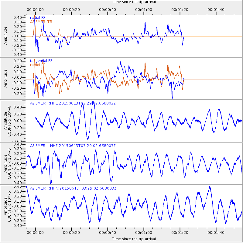
SMER AZ.SMER - Earthquake Result Viewer
*The percent match for this event was below the threshold and hence no stack was calculated.
| Earthquake location: |
South Of Fiji Islands |
| Earthquake latitude/longitude: |
-24.6/-176.2 |
| Earthquake time(UTC): |
2015/06/13 (164) 03:17:24 GMT |
| Earthquake Depth: |
22 km |
| Earthquake Magnitude: |
5.5 MWW, 5.5 MWB, 5.6 MWC |
| Earthquake Catalog/Contributor: |
NEIC PDE/NEIC COMCAT |
|
| Network: |
AZ ANZA Regional Network |
| Station: |
SMER AZ.SMER |
| Lat/Lon: |
33.46 N/117.17 W |
| Elevation: |
355 m |
|
| Distance: |
80.5 deg |
| Az: |
46.599 deg |
| Baz: |
232.298 deg |
| Ray Param: |
$rayparam |
*The percent match for this event was below the threshold and hence was not used in the summary stack. |
|
| Radial Match: |
61.657238 % |
| Radial Bump: |
400 |
| Transverse Match: |
60.420914 % |
| Transverse Bump: |
400 |
| SOD ConfigId: |
7422571 |
| Insert Time: |
2019-04-19 08:25:08.315 +0000 |
| GWidth: |
2.5 |
| Max Bumps: |
400 |
| Tol: |
0.001 |
|
Signal To Noise
| Channel | StoN | STA | LTA |
| AZ:SMER: :HHZ:20150613T03:29:02.668003Z | 1.0187546 | 1.2107132E-7 | 1.1884247E-7 |
| AZ:SMER: :HHN:20150613T03:29:02.668003Z | 1.140231 | 1.4044653E-7 | 1.2317375E-7 |
| AZ:SMER: :HHE:20150613T03:29:02.668003Z | 2.3924973 | 3.7975568E-7 | 1.5872773E-7 |
| Arrivals |
| Ps | |
| PpPs | |
| PsPs/PpSs | |


