GUMO Guam, Marianas Islands - Earthquake Result Viewer
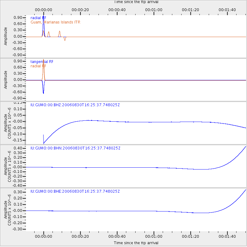
Earthquake location: Mauritius - Reunion Region
Earthquake latitude/longitude: -17.6/65.9
Earthquake time(UTC): 2006/08/30 (242) 16:13:39 GMT
Earthquake Depth: 10 km
Earthquake Magnitude: 4.8 MB, 4.6 MS, 5.7 MW, 5.6 MW
Earthquake Catalog/Contributor: WHDF/NEIC
Network: IU Global Seismograph Network (GSN - IRIS/USGS)
Station: GUMO Guam, Marianas Islands
Lat/Lon: 13.59 N/144.87 E
Elevation: 14 m
Distance: 83.8 deg
Az: 73.708 deg
Baz: 250.259 deg
Ray Param: 0.045921315
Estimated Moho Depth: 10.0 km
Estimated Crust Vp/Vs: 1.60
Assumed Crust Vp: 4.802 km/s
Estimated Crust Vs: 3.001 km/s
Estimated Crust Poisson's Ratio: 0.18
Radial Match: 99.99999 %
Radial Bump: 2
Transverse Match: 99.999985 %
Transverse Bump: 2
SOD ConfigId: 2665
Insert Time: 2010-03-03 14:39:43.022 +0000
GWidth: 2.5
Max Bumps: 400
Tol: 0.001

Signal To Noise

ChannelStoNSTALTA
IU:GUMO:00:BHN:20060830T16:25:37.748025Z0.912084943.400567E-83.7283446E-8
IU:GUMO:00:BHE:20060830T16:25:37.748025Z0.915720642.6262091E-82.8679153E-8
IU:GUMO:00:BHZ:20060830T16:25:37.748025Z0.911776964.9291152E-85.4060536E-8
Arrivals
Ps1.3 SECOND
PpPs5.3 SECOND
PsPs/PpSs6.6 SECOND