You are here: Home > Network List > UW - Pacific Northwest Regional Seismic Network Stations List
> Station UMAT Pilot Rock, OR, USA > Earthquake Result Viewer
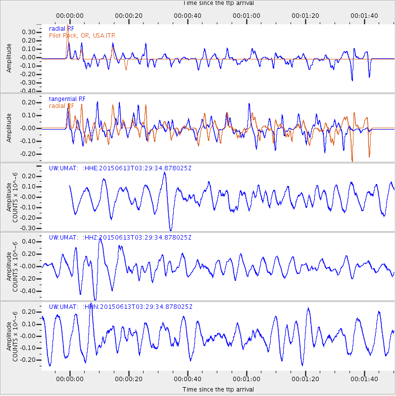
UMAT Pilot Rock, OR, USA - Earthquake Result Viewer
*The percent match for this event was below the threshold and hence no stack was calculated.
| Earthquake location: |
South Of Fiji Islands |
| Earthquake latitude/longitude: |
-24.6/-176.2 |
| Earthquake time(UTC): |
2015/06/13 (164) 03:17:24 GMT |
| Earthquake Depth: |
22 km |
| Earthquake Magnitude: |
5.5 MWW, 5.5 MWB, 5.6 MWC |
| Earthquake Catalog/Contributor: |
NEIC PDE/NEIC COMCAT |
|
| Network: |
UW Pacific Northwest Regional Seismic Network |
| Station: |
UMAT Pilot Rock, OR, USA |
| Lat/Lon: |
45.29 N/118.96 W |
| Elevation: |
1318 m |
|
| Distance: |
86.9 deg |
| Az: |
36.467 deg |
| Baz: |
230.042 deg |
| Ray Param: |
$rayparam |
*The percent match for this event was below the threshold and hence was not used in the summary stack. |
|
| Radial Match: |
46.79094 % |
| Radial Bump: |
274 |
| Transverse Match: |
64.237305 % |
| Transverse Bump: |
369 |
| SOD ConfigId: |
7422571 |
| Insert Time: |
2019-04-19 08:28:45.534 +0000 |
| GWidth: |
2.5 |
| Max Bumps: |
400 |
| Tol: |
0.001 |
|
Signal To Noise
| Channel | StoN | STA | LTA |
| UW:UMAT: :HHZ:20150613T03:29:34.878025Z | 3.2522078 | 2.0819175E-7 | 6.401551E-8 |
| UW:UMAT: :HHN:20150613T03:29:34.878025Z | 1.4187672 | 1.2645378E-7 | 8.9129344E-8 |
| UW:UMAT: :HHE:20150613T03:29:34.878025Z | 1.9976214 | 1.7919714E-7 | 8.970525E-8 |
| Arrivals |
| Ps | |
| PpPs | |
| PsPs/PpSs | |


