You are here: Home > Network List > CN - Canadian National Seismograph Network Stations List
> Station INK INUVIK, NT > Earthquake Result Viewer
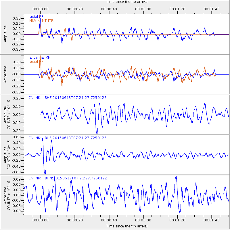
INK INUVIK, NT - Earthquake Result Viewer
*The percent match for this event was below the threshold and hence no stack was calculated.
| Earthquake location: |
Near N Coast Of New Guinea, P.N.G. |
| Earthquake latitude/longitude: |
-3.2/143.8 |
| Earthquake time(UTC): |
2015/06/13 (164) 07:08:58 GMT |
| Earthquake Depth: |
10 km |
| Earthquake Magnitude: |
5.6 MB |
| Earthquake Catalog/Contributor: |
NEIC PDE/NEIC ALERT |
|
| Network: |
CN Canadian National Seismograph Network |
| Station: |
INK INUVIK, NT |
| Lat/Lon: |
68.31 N/133.53 W |
| Elevation: |
44 m |
|
| Distance: |
90.3 deg |
| Az: |
21.637 deg |
| Baz: |
261.965 deg |
| Ray Param: |
$rayparam |
*The percent match for this event was below the threshold and hence was not used in the summary stack. |
|
| Radial Match: |
66.80742 % |
| Radial Bump: |
400 |
| Transverse Match: |
58.992355 % |
| Transverse Bump: |
400 |
| SOD ConfigId: |
7422571 |
| Insert Time: |
2019-04-19 08:31:57.892 +0000 |
| GWidth: |
2.5 |
| Max Bumps: |
400 |
| Tol: |
0.001 |
|
Signal To Noise
| Channel | StoN | STA | LTA |
| CN:INK: :BHZ:20150613T07:21:27.725012Z | 5.4107323 | 3.348729E-7 | 6.1890496E-8 |
| CN:INK: :BHN:20150613T07:21:27.725012Z | 1.0109466 | 3.8821625E-8 | 3.840126E-8 |
| CN:INK: :BHE:20150613T07:21:27.725012Z | 2.5617893 | 1.18349504E-7 | 4.6197982E-8 |
| Arrivals |
| Ps | |
| PpPs | |
| PsPs/PpSs | |


