You are here: Home > Network List > IU - Global Seismograph Network (GSN - IRIS/USGS) Stations List
> Station GUMO Guam, Marianas Islands > Earthquake Result Viewer
GUMO Guam, Marianas Islands - Earthquake Result Viewer

| Earthquake location: |
Tajikistan |
| Earthquake latitude/longitude: |
39.1/71.8 |
| Earthquake time(UTC): |
2006/07/06 (187) 03:57:53 GMT |
| Earthquake Depth: |
24 km |
| Earthquake Magnitude: |
5.6 MB, 5.7 MS, 5.7 MW, 5.7 MW |
| Earthquake Catalog/Contributor: |
WHDF/NEIC |
|
| Network: |
IU Global Seismograph Network (GSN - IRIS/USGS) |
| Station: |
GUMO Guam, Marianas Islands |
| Lat/Lon: |
13.59 N/144.87 E |
| Elevation: |
14 m |
|
| Distance: |
68.4 deg |
| Az: |
89.797 deg |
| Baz: |
306.884 deg |
| Ray Param: |
0.056265898 |
| Estimated Moho Depth: |
10.0 km |
| Estimated Crust Vp/Vs: |
1.60 |
| Assumed Crust Vp: |
4.802 km/s |
| Estimated Crust Vs: |
3.001 km/s |
| Estimated Crust Poisson's Ratio: |
0.18 |
|
| Radial Match: |
99.96833 % |
| Radial Bump: |
3 |
| Transverse Match: |
100.0 % |
| Transverse Bump: |
2 |
| SOD ConfigId: |
2665 |
| Insert Time: |
2010-03-03 14:40:12.136 +0000 |
| GWidth: |
2.5 |
| Max Bumps: |
400 |
| Tol: |
0.001 |
|
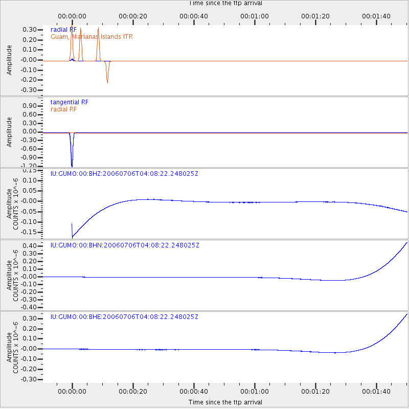
Signal To Noise
| Channel | StoN | STA | LTA |
| IU:GUMO:00:BHN:20060706T04:08:22.248025Z | 0.9117571 | 3.3862293E-8 | 3.7139596E-8 |
| IU:GUMO:00:BHE:20060706T04:08:22.248025Z | 0.8946754 | 2.5758759E-8 | 2.879118E-8 |
| IU:GUMO:00:BHZ:20060706T04:08:22.248025Z | 0.91046053 | 4.935546E-8 | 5.4209334E-8 |
| Arrivals |
| Ps | 1.3 SECOND |
| PpPs | 5.3 SECOND |
| PsPs/PpSs | 6.6 SECOND |


