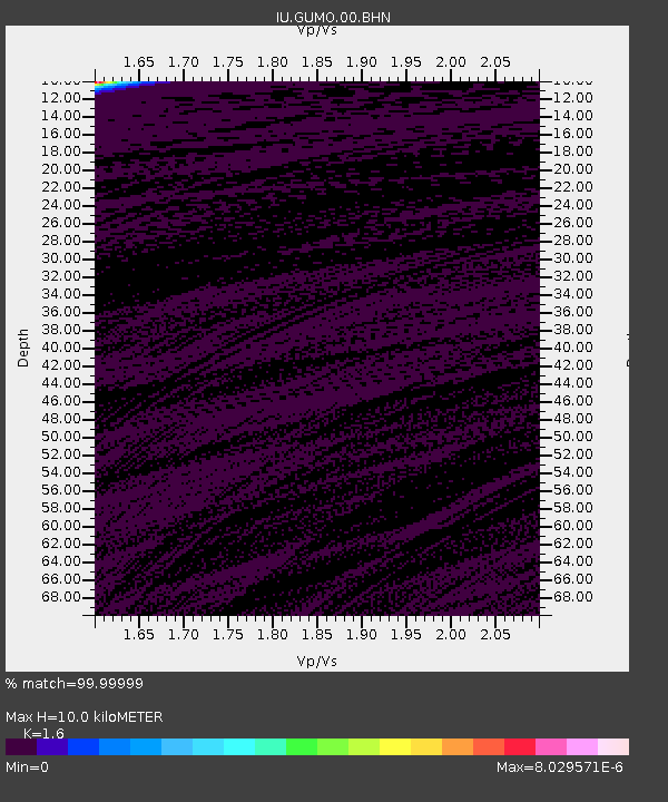
GUMO Guam, Marianas Islands - Earthquake Result Viewer
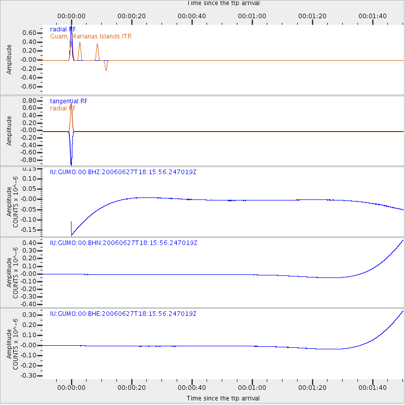
Earthquake location: Nicobar Islands, India Region
Earthquake latitude/longitude: 6.5/92.8
Earthquake time(UTC): 2006/06/27 (178) 18:07:22 GMT
Earthquake Depth: 29 km
Earthquake Magnitude: 5.8 MB, 6.1 MS, 6.2 MW, 5.9 MW
Earthquake Catalog/Contributor: WHDF/NEIC
Network: IU Global Seismograph Network (GSN - IRIS/USGS)
Station: GUMO Guam, Marianas Islands
Lat/Lon: 13.59 N/144.87 E
Elevation: 14 m
Distance: 51.7 deg
Az: 77.878 deg
Baz: 267.573 deg
Ray Param: 0.067208454
Estimated Moho Depth: 10.0 km
Estimated Crust Vp/Vs: 1.60
Assumed Crust Vp: 4.802 km/s
Estimated Crust Vs: 3.001 km/s
Estimated Crust Poisson's Ratio: 0.18
Radial Match: 99.99999 %
Radial Bump: 2
Transverse Match: 99.99999 %
Transverse Bump: 2
SOD ConfigId: 2665
Insert Time: 2010-03-03 14:40:14.863 +0000
GWidth: 2.5
Max Bumps: 400
Tol: 0.001

Signal To Noise

ChannelStoNSTALTA
IU:GUMO:00:BHN:20060627T18:15:56.247019Z0.910242143.3865298E-83.7204714E-8
IU:GUMO:00:BHE:20060627T18:15:56.247019Z0.910125262.6093694E-82.8670442E-8
IU:GUMO:00:BHZ:20060627T18:15:56.247019Z0.91177834.9428436E-85.421103E-8
Arrivals
Ps1.3 SECOND
PpPs5.2 SECOND
PsPs/PpSs6.5 SECOND