GUMO Guam, Marianas Islands - Earthquake Result Viewer
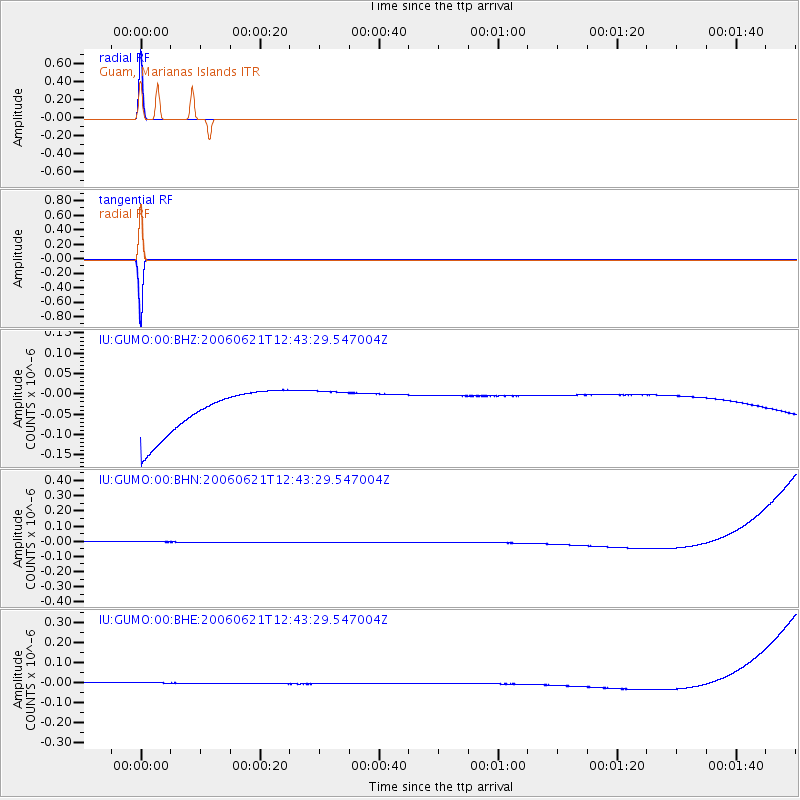
Earthquake location: Nicobar Islands, India Region
Earthquake latitude/longitude: 6.9/92.5
Earthquake time(UTC): 2006/06/21 (172) 12:34:52 GMT
Earthquake Depth: 16 km
Earthquake Magnitude: 5.7 MB, 5.7 MS, 5.9 MW, 5.9 MW
Earthquake Catalog/Contributor: WHDF/NEIC
Network: IU Global Seismograph Network (GSN - IRIS/USGS)
Station: GUMO Guam, Marianas Islands
Lat/Lon: 13.59 N/144.87 E
Elevation: 14 m
Distance: 51.9 deg
Az: 78.227 deg
Baz: 268.203 deg
Ray Param: 0.06708518
Estimated Moho Depth: 69.75 km
Estimated Crust Vp/Vs: 2.05
Assumed Crust Vp: 4.802 km/s
Estimated Crust Vs: 2.342 km/s
Estimated Crust Poisson's Ratio: 0.34
Radial Match: 99.99999 %
Radial Bump: 2
Transverse Match: 99.99999 %
Transverse Bump: 2
SOD ConfigId: 2665
Insert Time: 2010-03-03 14:40:16.029 +0000
GWidth: 2.5
Max Bumps: 400
Tol: 0.001

Signal To Noise

ChannelStoNSTALTA
IU:GUMO:00:BHN:20060621T12:43:29.547004Z0.92053693.4135237E-83.7081875E-8
IU:GUMO:00:BHE:20060621T12:43:29.547004Z0.91536652.6131223E-82.854728E-8
IU:GUMO:00:BHZ:20060621T12:43:29.547004Z0.91333364.9447795E-85.4139903E-8
Arrivals
Ps16 SECOND
PpPs43 SECOND
PsPs/PpSs59 SECOND