GUMO Guam, Marianas Islands - Earthquake Result Viewer
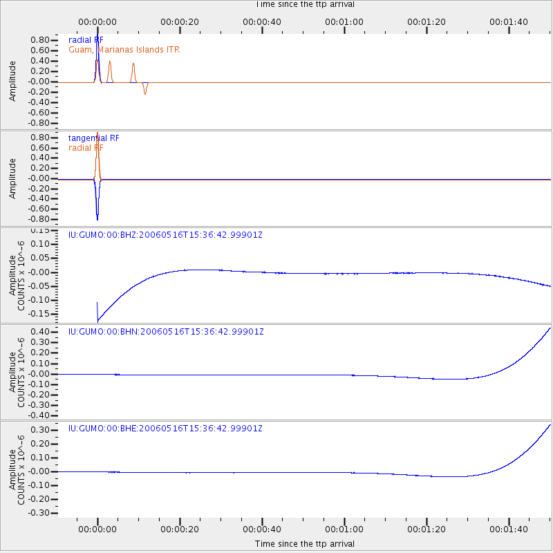
Earthquake location: Northern Sumatra, Indonesia
Earthquake latitude/longitude: 0.1/97.1
Earthquake time(UTC): 2006/05/16 (136) 15:28:25 GMT
Earthquake Depth: 12 km
Earthquake Magnitude: 6.6 MB, 6.8 MS, 6.8 MW, 6.8 MW
Earthquake Catalog/Contributor: WHDF/NEIC
Network: IU Global Seismograph Network (GSN - IRIS/USGS)
Station: GUMO Guam, Marianas Islands
Lat/Lon: 13.59 N/144.87 E
Elevation: 14 m
Distance: 49.2 deg
Az: 72.124 deg
Baz: 258.171 deg
Ray Param: 0.068842836
Estimated Moho Depth: 10.0 km
Estimated Crust Vp/Vs: 1.60
Assumed Crust Vp: 4.802 km/s
Estimated Crust Vs: 3.001 km/s
Estimated Crust Poisson's Ratio: 0.18
Radial Match: 99.999985 %
Radial Bump: 2
Transverse Match: 99.999985 %
Transverse Bump: 2
SOD ConfigId: 2669
Insert Time: 2010-03-03 14:40:17.094 +0000
GWidth: 2.5
Max Bumps: 400
Tol: 0.001

Signal To Noise

ChannelStoNSTALTA
IU:GUMO:00:BHN:20060516T15:36:42.99901Z0.9166363.4052764E-83.7149714E-8
IU:GUMO:00:BHE:20060516T15:36:42.99901Z0.914533562.6210156E-82.865959E-8
IU:GUMO:00:BHZ:20060516T15:36:42.99901Z0.916307574.963706E-85.417074E-8
Arrivals
Ps1.3 SECOND
PpPs5.2 SECOND
PsPs/PpSs6.5 SECOND