GUMO Guam, Marianas Islands - Earthquake Result Viewer
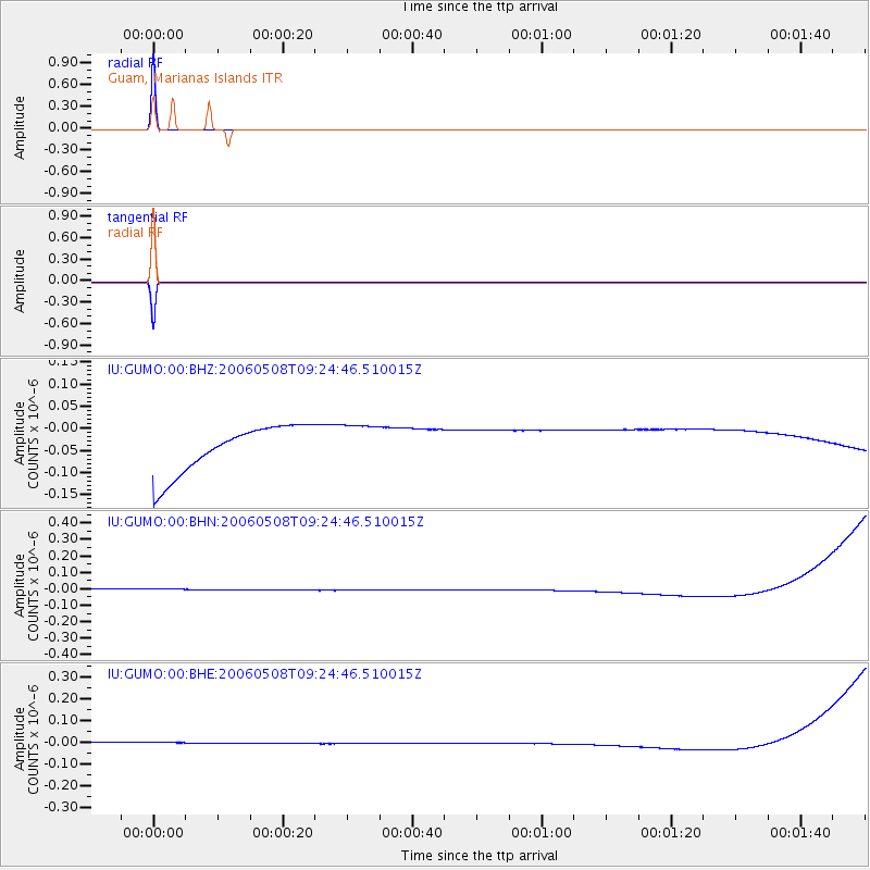
Earthquake location: Southern Sumatra, Indonesia
Earthquake latitude/longitude: -4.8/102.4
Earthquake time(UTC): 2006/05/08 (128) 09:16:57 GMT
Earthquake Depth: 43 km
Earthquake Magnitude: 5.8 MB, 5.7 MS, 5.9 MW, 5.8 MW
Earthquake Catalog/Contributor: WHDF/NEIC
Network: IU Global Seismograph Network (GSN - IRIS/USGS)
Station: GUMO Guam, Marianas Islands
Lat/Lon: 13.59 N/144.87 E
Elevation: 14 m
Distance: 46.0 deg
Az: 65.99 deg
Baz: 249.411 deg
Ray Param: 0.07081868
Estimated Moho Depth: 10.0 km
Estimated Crust Vp/Vs: 1.60
Assumed Crust Vp: 4.802 km/s
Estimated Crust Vs: 3.001 km/s
Estimated Crust Poisson's Ratio: 0.18
Radial Match: 99.99999 %
Radial Bump: 2
Transverse Match: 99.999985 %
Transverse Bump: 2
SOD ConfigId: 2669
Insert Time: 2010-03-03 14:40:21.788 +0000
GWidth: 2.5
Max Bumps: 400
Tol: 0.001

Signal To Noise

ChannelStoNSTALTA
IU:GUMO:00:BHN:20060508T09:24:46.510015Z0.91774733.414847E-83.7209013E-8
IU:GUMO:00:BHE:20060508T09:24:46.510015Z0.91314272.6259357E-82.8757123E-8
IU:GUMO:00:BHZ:20060508T09:24:46.510015Z0.91536724.9518167E-85.4096507E-8
Arrivals
Ps1.3 SECOND
PpPs5.2 SECOND
PsPs/PpSs6.5 SECOND