You are here: Home > Network List > US - United States National Seismic Network Stations List
> Station ELK Elko, Nevada, USA > Earthquake Result Viewer
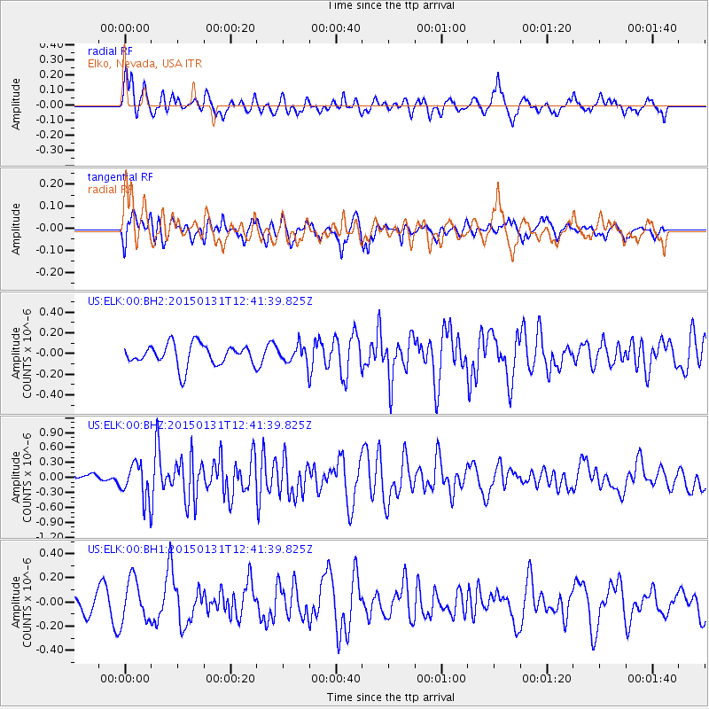
ELK Elko, Nevada, USA - Earthquake Result Viewer
*The percent match for this event was below the threshold and hence no stack was calculated.
| Earthquake location: |
Mariana Islands Region |
| Earthquake latitude/longitude: |
15.3/147.1 |
| Earthquake time(UTC): |
2015/01/31 (031) 12:29:31 GMT |
| Earthquake Depth: |
10 km |
| Earthquake Magnitude: |
5.7 MO |
| Earthquake Catalog/Contributor: |
NEIC PDE/NEIC ALERT |
|
| Network: |
US United States National Seismic Network |
| Station: |
ELK Elko, Nevada, USA |
| Lat/Lon: |
40.74 N/115.24 W |
| Elevation: |
2210 m |
|
| Distance: |
85.8 deg |
| Az: |
49.027 deg |
| Baz: |
286.456 deg |
| Ray Param: |
$rayparam |
*The percent match for this event was below the threshold and hence was not used in the summary stack. |
|
| Radial Match: |
64.83721 % |
| Radial Bump: |
400 |
| Transverse Match: |
47.570904 % |
| Transverse Bump: |
358 |
| SOD ConfigId: |
837871 |
| Insert Time: |
2015-02-14 12:39:12.168 +0000 |
| GWidth: |
2.5 |
| Max Bumps: |
400 |
| Tol: |
0.001 |
|
Signal To Noise
| Channel | StoN | STA | LTA |
| US:ELK:00:BHZ:20150131T12:41:39.825Z | 3.0434642 | 3.64731E-7 | 1.1984073E-7 |
| US:ELK:00:BH1:20150131T12:41:39.825Z | 2.06741 | 1.7413574E-7 | 8.422894E-8 |
| US:ELK:00:BH2:20150131T12:41:39.825Z | 0.8218572 | 8.492844E-8 | 1.0333722E-7 |
| Arrivals |
| Ps | |
| PpPs | |
| PsPs/PpSs | |


