You are here: Home > Network List > AV - Alaska Volcano Observatory Stations List
> Station MAPS Pakushin Southeast, Makushin Volcano, Alaska > Earthquake Result Viewer
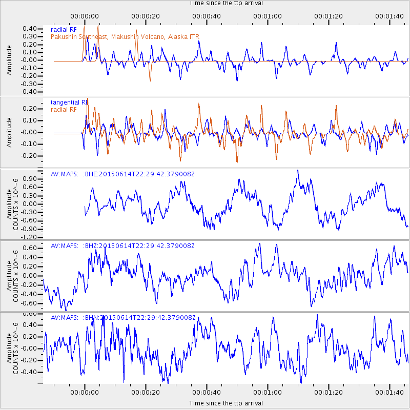
MAPS Pakushin Southeast, Makushin Volcano, Alaska - Earthquake Result Viewer
*The percent match for this event was below the threshold and hence no stack was calculated.
| Earthquake location: |
Bonin Islands, Japan Region |
| Earthquake latitude/longitude: |
27.4/140.1 |
| Earthquake time(UTC): |
2015/06/14 (165) 22:22:20 GMT |
| Earthquake Depth: |
385 km |
| Earthquake Magnitude: |
4.9 mb |
| Earthquake Catalog/Contributor: |
ISC/ISC |
|
| Network: |
AV Alaska Volcano Observatory |
| Station: |
MAPS Pakushin Southeast, Makushin Volcano, Alaska |
| Lat/Lon: |
53.81 N/166.94 W |
| Elevation: |
333 m |
|
| Distance: |
46.7 deg |
| Az: |
40.582 deg |
| Baz: |
257.287 deg |
| Ray Param: |
$rayparam |
*The percent match for this event was below the threshold and hence was not used in the summary stack. |
|
| Radial Match: |
45.39146 % |
| Radial Bump: |
387 |
| Transverse Match: |
38.794266 % |
| Transverse Bump: |
400 |
| SOD ConfigId: |
7422571 |
| Insert Time: |
2019-04-19 08:40:27.487 +0000 |
| GWidth: |
2.5 |
| Max Bumps: |
400 |
| Tol: |
0.001 |
|
Signal To Noise
| Channel | StoN | STA | LTA |
| AV:MAPS: :BHZ:20150614T22:29:42.379008Z | 0.9296049 | 3.7912147E-7 | 4.0783075E-7 |
| AV:MAPS: :BHN:20150614T22:29:42.379008Z | 1.2591771 | 3.2579095E-7 | 2.5873322E-7 |
| AV:MAPS: :BHE:20150614T22:29:42.379008Z | 1.762245 | 5.101712E-7 | 2.8950072E-7 |
| Arrivals |
| Ps | |
| PpPs | |
| PsPs/PpSs | |


