You are here: Home > Network List > IU - Global Seismograph Network (GSN - IRIS/USGS) Stations List
> Station GUMO Guam, Marianas Islands > Earthquake Result Viewer
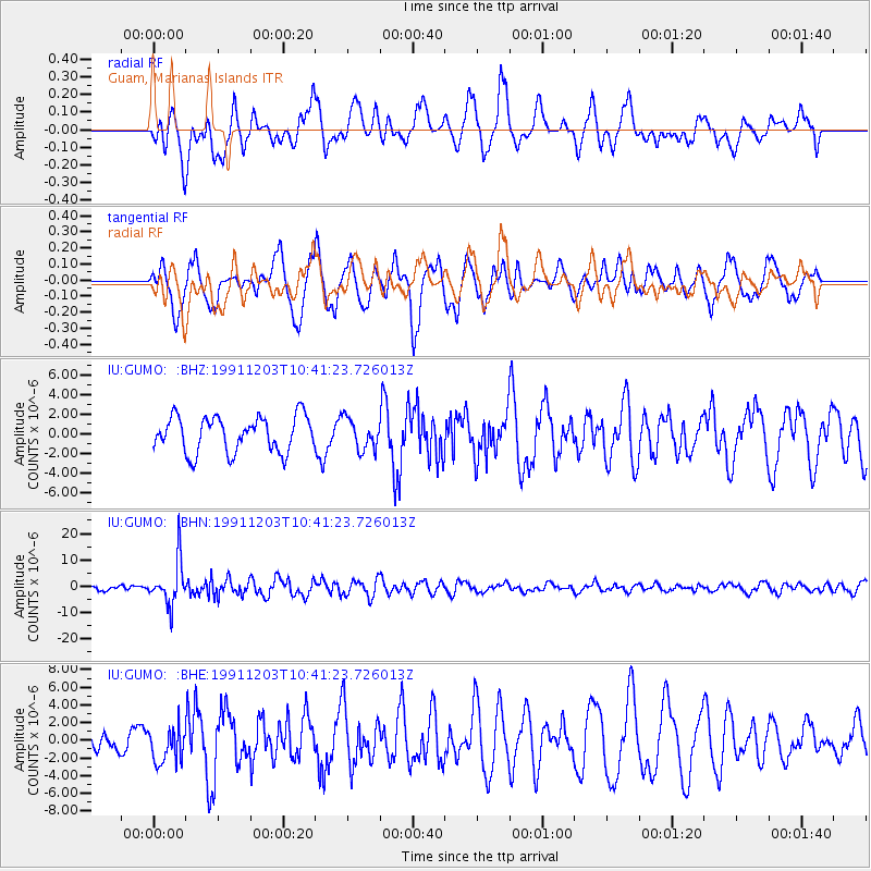
GUMO Guam, Marianas Islands - Earthquake Result Viewer
*The percent match for this event was below the threshold and hence no stack was calculated.
| Earthquake location: |
South Of Fiji Islands |
| Earthquake latitude/longitude: |
-26.3/178.6 |
| Earthquake time(UTC): |
1991/12/03 (337) 10:33:42 GMT |
| Earthquake Depth: |
581 km |
| Earthquake Magnitude: |
5.8 MB |
| Earthquake Catalog/Contributor: |
WHDF/NEIC |
|
| Network: |
IU Global Seismograph Network (GSN - IRIS/USGS) |
| Station: |
GUMO Guam, Marianas Islands |
| Lat/Lon: |
13.59 N/144.87 E |
| Elevation: |
14 m |
|
| Distance: |
51.5 deg |
| Az: |
316.381 deg |
| Baz: |
140.448 deg |
| Ray Param: |
$rayparam |
*The percent match for this event was below the threshold and hence was not used in the summary stack. |
|
| Radial Match: |
63.925312 % |
| Radial Bump: |
400 |
| Transverse Match: |
62.189198 % |
| Transverse Bump: |
400 |
| SOD ConfigId: |
4480 |
| Insert Time: |
2010-03-03 14:42:44.422 +0000 |
| GWidth: |
2.5 |
| Max Bumps: |
400 |
| Tol: |
0.001 |
|
Signal To Noise
| Channel | StoN | STA | LTA |
| IU:GUMO: :BHN:19911203T10:41:23.726013Z | 8.243898 | 8.390914E-6 | 1.0178333E-6 |
| IU:GUMO: :BHE:19911203T10:41:23.726013Z | 1.4636484 | 2.0288744E-6 | 1.386176E-6 |
| IU:GUMO: :BHZ:19911203T10:41:23.726013Z | 0.86883694 | 1.5750227E-6 | 1.8127943E-6 |
| Arrivals |
| Ps | |
| PpPs | |
| PsPs/PpSs | |


