You are here: Home > Network List > IU - Global Seismograph Network (GSN - IRIS/USGS) Stations List
> Station GUMO Guam, Marianas Islands > Earthquake Result Viewer
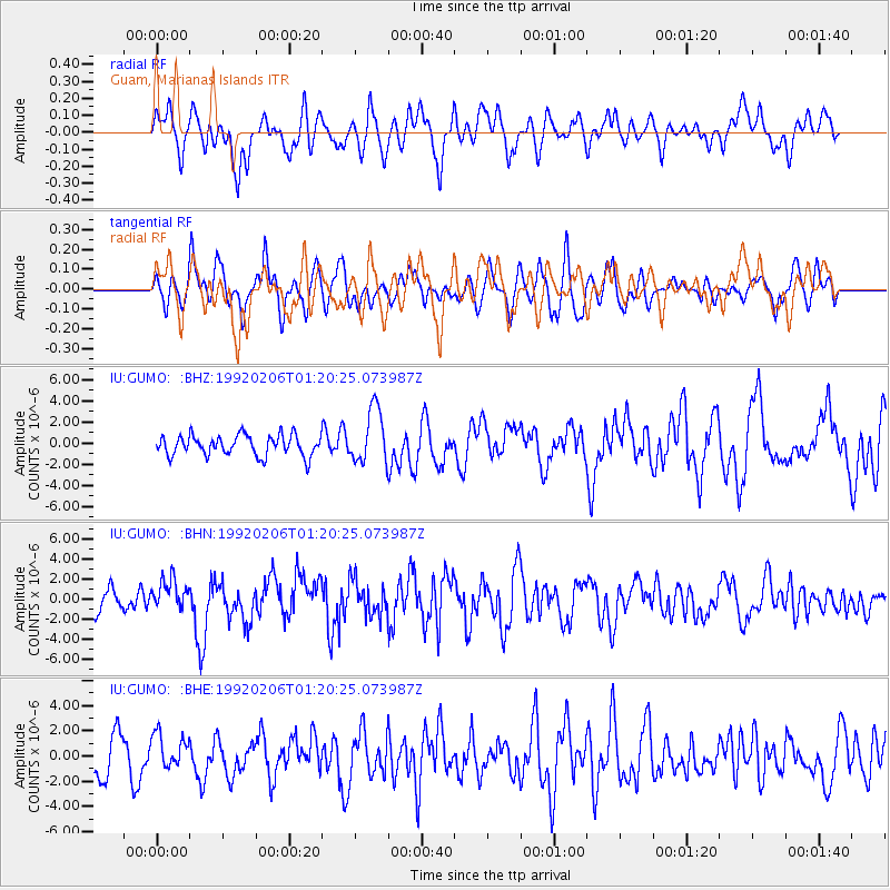
GUMO Guam, Marianas Islands - Earthquake Result Viewer
*The percent match for this event was below the threshold and hence no stack was calculated.
| Earthquake location: |
Southern Sumatra, Indonesia |
| Earthquake latitude/longitude: |
-5.8/103.2 |
| Earthquake time(UTC): |
1992/02/06 (037) 01:12:39 GMT |
| Earthquake Depth: |
45 km |
| Earthquake Magnitude: |
5.9 MB, 6.4 MS, 6.3 UNKNOWN |
| Earthquake Catalog/Contributor: |
WHDF/NEIC |
|
| Network: |
IU Global Seismograph Network (GSN - IRIS/USGS) |
| Station: |
GUMO Guam, Marianas Islands |
| Lat/Lon: |
13.59 N/144.87 E |
| Elevation: |
14 m |
|
| Distance: |
45.7 deg |
| Az: |
64.781 deg |
| Baz: |
247.781 deg |
| Ray Param: |
$rayparam |
*The percent match for this event was below the threshold and hence was not used in the summary stack. |
|
| Radial Match: |
57.796917 % |
| Radial Bump: |
400 |
| Transverse Match: |
46.4152 % |
| Transverse Bump: |
400 |
| SOD ConfigId: |
4480 |
| Insert Time: |
2010-03-03 14:42:45.177 +0000 |
| GWidth: |
2.5 |
| Max Bumps: |
400 |
| Tol: |
0.001 |
|
Signal To Noise
| Channel | StoN | STA | LTA |
| IU:GUMO: :BHN:19920206T01:20:25.073987Z | 1.6755012 | 1.5053947E-6 | 8.984743E-7 |
| IU:GUMO: :BHE:19920206T01:20:25.073987Z | 0.7921803 | 1.3452834E-6 | 1.6982034E-6 |
| IU:GUMO: :BHZ:19920206T01:20:25.073987Z | 2.6693966 | 2.5861414E-6 | 9.688112E-7 |
| Arrivals |
| Ps | |
| PpPs | |
| PsPs/PpSs | |


