You are here: Home > Network List > WY - Yellowstone Wyoming Seismic Network Stations List
> Station YHR Hawk's Rest, WY, USA > Earthquake Result Viewer
YHR Hawk's Rest, WY, USA - Earthquake Result Viewer
*The percent match for this event was below the threshold and hence no stack was calculated.
| Earthquake location: |
Southeast Of Loyalty Islands |
| Earthquake latitude/longitude: |
-21.3/170.3 |
| Earthquake time(UTC): |
2015/02/01 (032) 13:34:07 GMT |
| Earthquake Depth: |
33 km |
| Earthquake Magnitude: |
5.8 MO |
| Earthquake Catalog/Contributor: |
NEIC PDE/NEIC ALERT |
|
| Network: |
WY Yellowstone Wyoming Seismic Network |
| Station: |
YHR Hawk's Rest, WY, USA |
| Lat/Lon: |
44.11 N/110.08 W |
| Elevation: |
2976 m |
|
| Distance: |
97.4 deg |
| Az: |
45.608 deg |
| Baz: |
247.655 deg |
| Ray Param: |
$rayparam |
*The percent match for this event was below the threshold and hence was not used in the summary stack. |
|
| Radial Match: |
46.482475 % |
| Radial Bump: |
400 |
| Transverse Match: |
42.544155 % |
| Transverse Bump: |
400 |
| SOD ConfigId: |
837871 |
| Insert Time: |
2015-02-15 13:44:58.521 +0000 |
| GWidth: |
2.5 |
| Max Bumps: |
400 |
| Tol: |
0.001 |
|
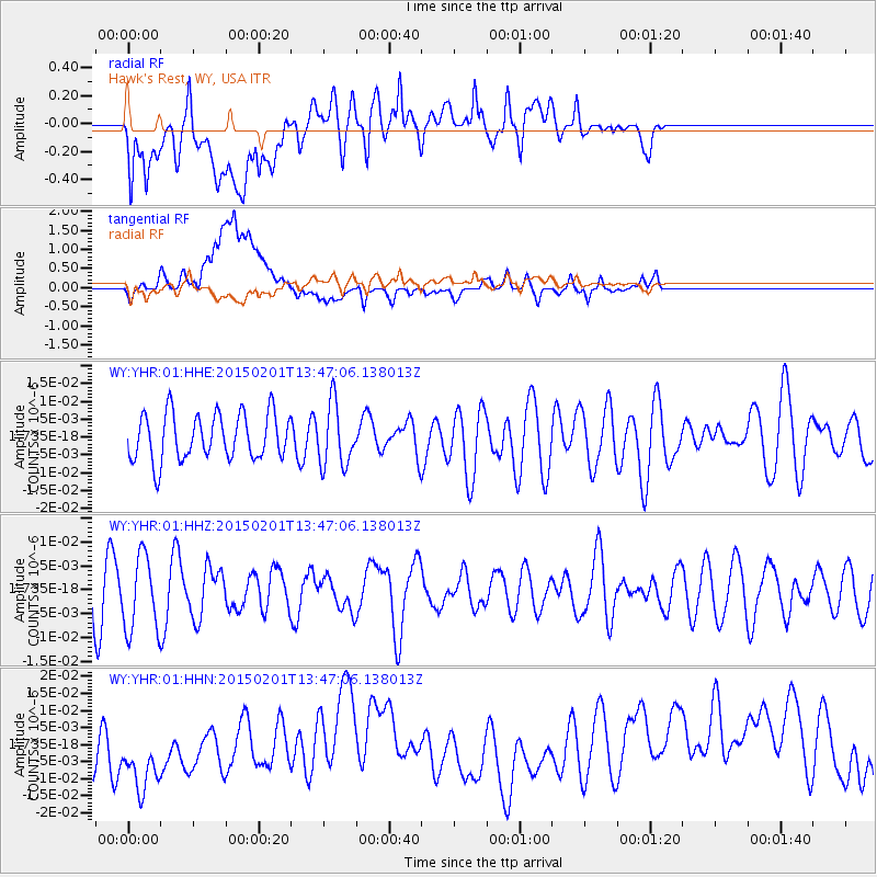
Signal To Noise
| Channel | StoN | STA | LTA |
| WY:YHR:01:HHZ:20150201T13:47:06.138013Z | 1.5202594 | 7.728173E-9 | 5.0834563E-9 |
| WY:YHR:01:HHN:20150201T13:47:06.138013Z | 1.1635725 | 1.9225997E-8 | 1.6523247E-8 |
| WY:YHR:01:HHE:20150201T13:47:06.138013Z | 1.36151 | 8.80633E-9 | 6.468061E-9 |
| Arrivals |
| Ps | |
| PpPs | |
| PsPs/PpSs | |


