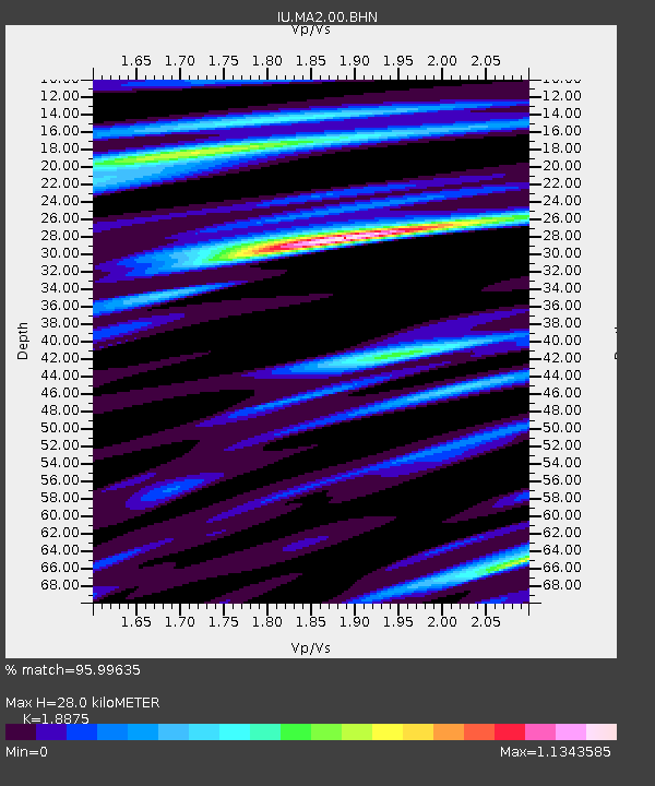
MA2 Magadan, Russia - Earthquake Result Viewer
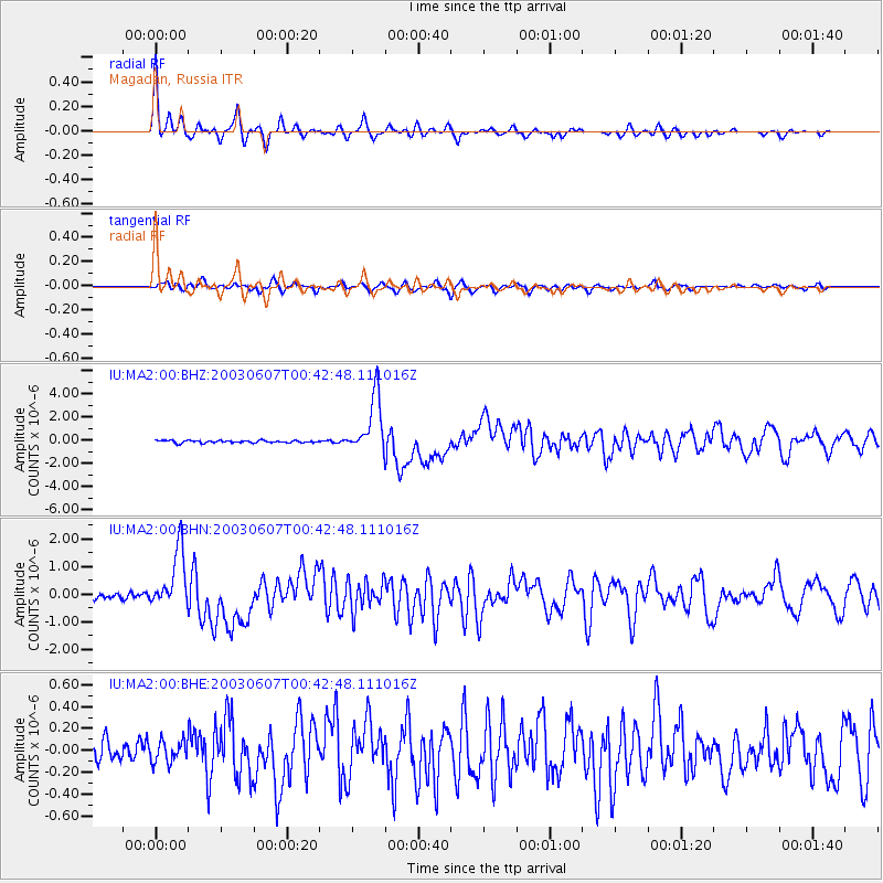
Earthquake location: New Britain Region, P.N.G.
Earthquake latitude/longitude: -5.1/152.5
Earthquake time(UTC): 2003/06/07 (158) 00:32:45 GMT
Earthquake Depth: 33 km
Earthquake Magnitude: 6.0 MB, 6.8 MS, 6.6 MW, 6.5 MW
Earthquake Catalog/Contributor: WHDF/NEIC
Network: IU Global Seismograph Network (GSN - IRIS/USGS)
Station: MA2 Magadan, Russia
Lat/Lon: 59.58 N/150.77 E
Elevation: 339 m
Distance: 64.5 deg
Az: 359.023 deg
Baz: 178.088 deg
Ray Param: 0.058840834
Estimated Moho Depth: 28.0 km
Estimated Crust Vp/Vs: 1.89
Assumed Crust Vp: 6.134 km/s
Estimated Crust Vs: 3.25 km/s
Estimated Crust Poisson's Ratio: 0.30
Radial Match: 95.99635 %
Radial Bump: 280
Transverse Match: 74.375336 %
Transverse Bump: 400
SOD ConfigId: 4714
Insert Time: 2010-03-03 14:44:28.512 +0000
GWidth: 2.5
Max Bumps: 400
Tol: 0.001

Signal To Noise

ChannelStoNSTALTA
IU:MA2:00:BHN:20030607T00:42:48.111016Z9.4131321.0553846E-61.1211832E-7
IU:MA2:00:BHE:20030607T00:42:48.111016Z1.11040669.726186E-88.759121E-8
IU:MA2:00:BHZ:20030607T00:42:48.111016Z24.0224082.4222722E-61.00833866E-7
Arrivals
Ps4.2 SECOND
PpPs13 SECOND
PsPs/PpSs17 SECOND