You are here: Home > Network List > TA - USArray Transportable Network (new EarthScope stations) Stations List
> Station 109C Camp Elliot, Mirimar, CA, USA > Earthquake Result Viewer
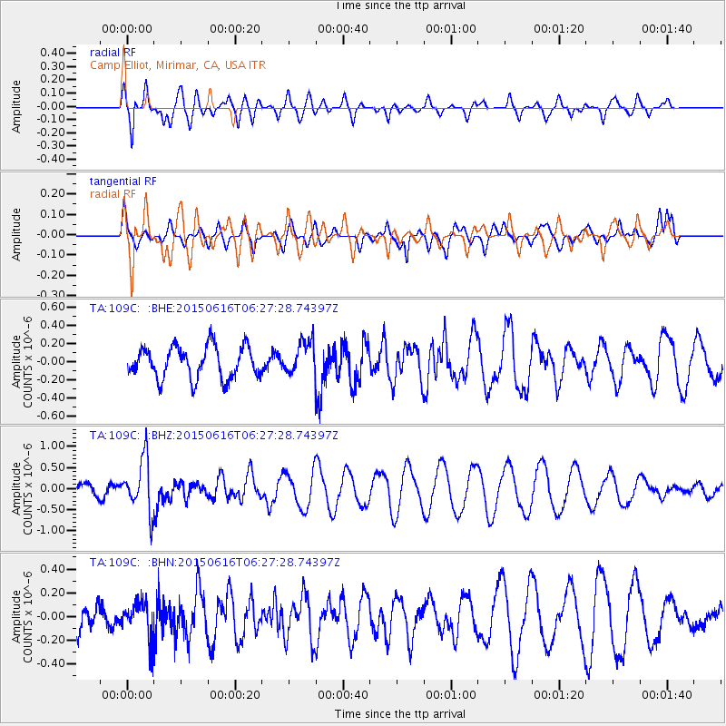
109C Camp Elliot, Mirimar, CA, USA - Earthquake Result Viewer
*The percent match for this event was below the threshold and hence no stack was calculated.
| Earthquake location: |
Fiji Islands Region |
| Earthquake latitude/longitude: |
-20.4/-178.9 |
| Earthquake time(UTC): |
2015/06/16 (167) 06:16:59 GMT |
| Earthquake Depth: |
646 km |
| Earthquake Magnitude: |
5.9 MO |
| Earthquake Catalog/Contributor: |
NEIC PDE/NEIC ALERT |
|
| Network: |
TA USArray Transportable Network (new EarthScope stations) |
| Station: |
109C Camp Elliot, Mirimar, CA, USA |
| Lat/Lon: |
32.89 N/117.11 W |
| Elevation: |
150 m |
|
| Distance: |
79.3 deg |
| Az: |
49.003 deg |
| Baz: |
237.293 deg |
| Ray Param: |
$rayparam |
*The percent match for this event was below the threshold and hence was not used in the summary stack. |
|
| Radial Match: |
87.1213 % |
| Radial Bump: |
400 |
| Transverse Match: |
46.717606 % |
| Transverse Bump: |
400 |
| SOD ConfigId: |
7422571 |
| Insert Time: |
2019-04-19 09:02:09.442 +0000 |
| GWidth: |
2.5 |
| Max Bumps: |
400 |
| Tol: |
0.001 |
|
Signal To Noise
| Channel | StoN | STA | LTA |
| TA:109C: :BHZ:20150616T06:27:28.74397Z | 3.9624343 | 6.3412466E-7 | 1.600341E-7 |
| TA:109C: :BHN:20150616T06:27:28.74397Z | 1.4078355 | 1.4901917E-7 | 1.0584984E-7 |
| TA:109C: :BHE:20150616T06:27:28.74397Z | 1.4335593 | 2.5023635E-7 | 1.7455598E-7 |
| Arrivals |
| Ps | |
| PpPs | |
| PsPs/PpSs | |


