You are here: Home > Network List > UW - Pacific Northwest Regional Seismic Network Stations List
> Station LEBA Lebam, WA, USA > Earthquake Result Viewer
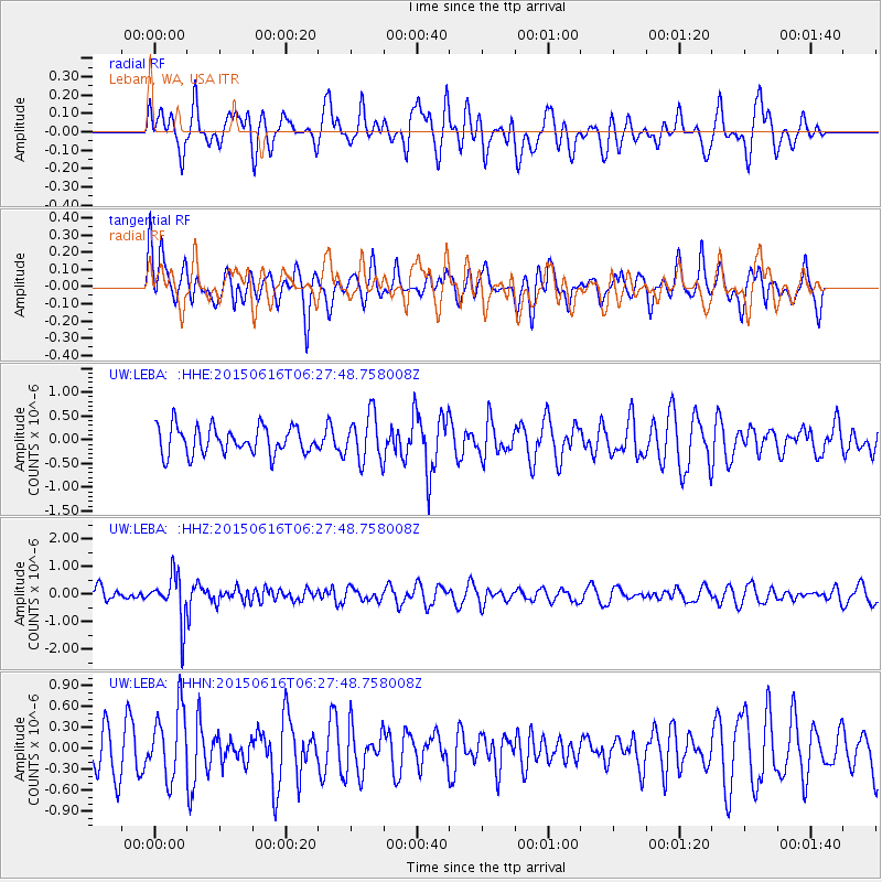
LEBA Lebam, WA, USA - Earthquake Result Viewer
*The percent match for this event was below the threshold and hence no stack was calculated.
| Earthquake location: |
Fiji Islands Region |
| Earthquake latitude/longitude: |
-20.4/-178.9 |
| Earthquake time(UTC): |
2015/06/16 (167) 06:16:59 GMT |
| Earthquake Depth: |
646 km |
| Earthquake Magnitude: |
5.9 MO |
| Earthquake Catalog/Contributor: |
NEIC PDE/NEIC ALERT |
|
| Network: |
UW Pacific Northwest Regional Seismic Network |
| Station: |
LEBA Lebam, WA, USA |
| Lat/Lon: |
46.55 N/123.56 W |
| Elevation: |
73 m |
|
| Distance: |
83.3 deg |
| Az: |
34.877 deg |
| Baz: |
230.999 deg |
| Ray Param: |
$rayparam |
*The percent match for this event was below the threshold and hence was not used in the summary stack. |
|
| Radial Match: |
49.60457 % |
| Radial Bump: |
400 |
| Transverse Match: |
52.444542 % |
| Transverse Bump: |
400 |
| SOD ConfigId: |
7422571 |
| Insert Time: |
2019-04-19 09:03:36.863 +0000 |
| GWidth: |
2.5 |
| Max Bumps: |
400 |
| Tol: |
0.001 |
|
Signal To Noise
| Channel | StoN | STA | LTA |
| UW:LEBA: :HHZ:20150616T06:27:48.758008Z | 2.473914 | 8.4448754E-7 | 3.413569E-7 |
| UW:LEBA: :HHN:20150616T06:27:48.758008Z | 1.3293217 | 5.0409955E-7 | 3.792156E-7 |
| UW:LEBA: :HHE:20150616T06:27:48.758008Z | 1.8130847 | 5.0639994E-7 | 2.7930298E-7 |
| Arrivals |
| Ps | |
| PpPs | |
| PsPs/PpSs | |


